Tell Mutubis
Tell Mutubis
Introduction
The tell near the modern city of Mutubas had previously been visited and documented by Penelope Wilson (P. Wilson and D. Grigoropoulos, West Delta Survey, pp.195-201) and Jeffrey and Patricia Spencer in 1992, but a more intensive survey seemed appropriate given the size of the site and its location.
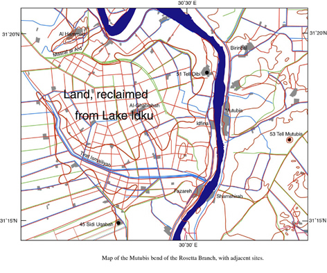
Map showing the location of the site.
Click image to view at full-size. (Requires PDF Viewer browser plug-in.)
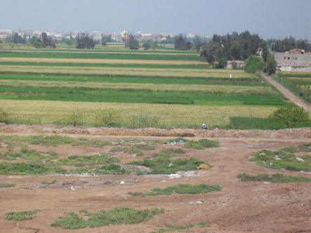
The tell is the largest northernmost site on the west side of the Rosetta Branch of the river and, in the recent past, seems to have been close to an inlet of the Burullus marsh-lake area (according to the maps of the Description de l’Égypte).
Intensive survey work was begun in Spring 2012, but the projected geophysical work was not possible this year due to organisational reasons.
1. Pottery survey
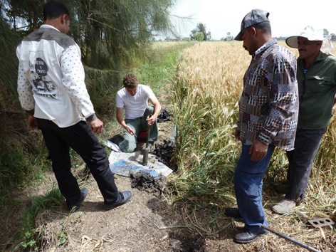
The survey was conducted in two specific ways: firstly, by setting out 25 metre squares, randomly, across the site and recording the material found in the squares. This material tended to provide a good corpus for the surface material. Secondly, by recording pottery associated with any stratigraphic features across the site such as natural sections of holes or pits, which had been dug on the site. The aim of this phase of the survey was to correlate pottery with stratigraphic layers on the site.
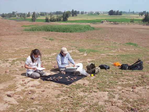
Ceramicists recording material in the field. from left to right: Hind Ramadan, Aude Simony, Mikaël Pesenti (C. Malleson).
Report by Mikaël Pesenti and Aude Simony.
The first step of the survey was to create the methodology in order to carry out the ceramic survey of Tell Mutubis/Kom el Ahmar in order to identify areas of concentration of specific types of pottery, and to create a corpus of the surface ceramic material. The survey first started on the eastern part of the top of the tell. The area surveyed was divided into squares (25 metres by 25 metres) from the South to the North (Square A1 to A6, B6 and B3). Each square was surveyed, and described according to the apparent concentration of cultural material.
Surveying the squares (C. Malleson).
Then, the diagnostic sherds were photographed, described according to their shape and fabric, and drawn.
Recording pottery (C. Malleson).
The second step consisted of surveying the western part area of the tell using the same methodology (Square B3 to G3). Based on the time remaining for the survey, the squares located on this Eastern-Western line were not so systematically surveyed. As with the previous squares, the diagnostic sherds were collected and documented.
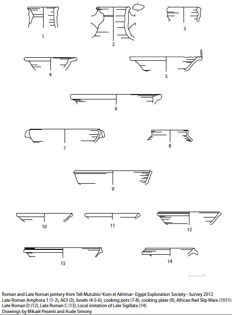
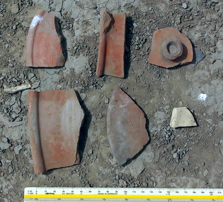
The major types of pottery in the corpus (M. Pesenti, A. Simony).
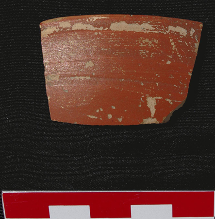
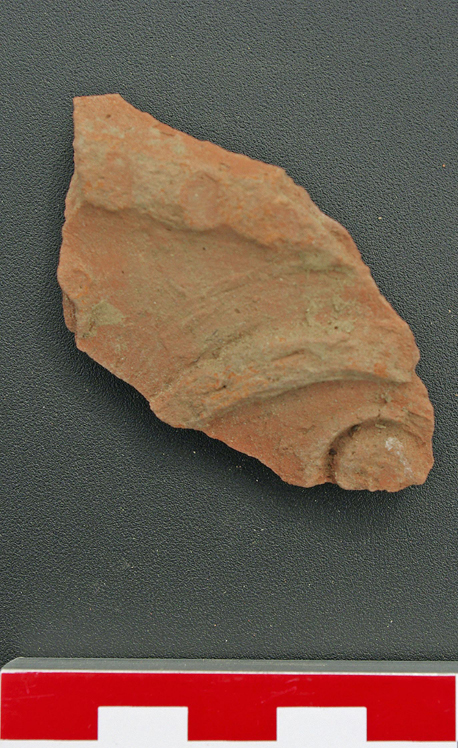
A fragment of Eastern Sigilliata bowl (M. Pesenti).
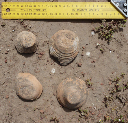
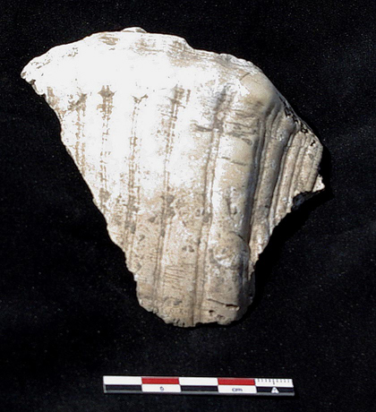
Bases from LR1 amphorae.
The first conclusions made on the basis of the observations in the field and the diagnostics material collected suggested a chronological range from Early Roman to Late Roman time (1st century AD to 7th century AD) with some types very well represented (LRA 1, ARSW, local fine wares).
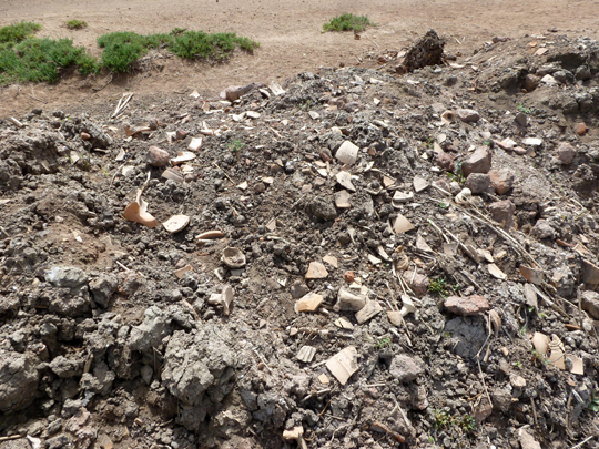
The last part of the survey was dedicated to the collection of the surface’s sherds from the surrounding areas of the modern holes, particularly numerous and sometimes very deep, located on the western part of the Tell. The pottery collected in these area seems include a chronological date range from the end of Ptolemaic times (1st century BC) to Late Roman times (around 7th century AD) on the basis of the earliest and latest fragments identified.
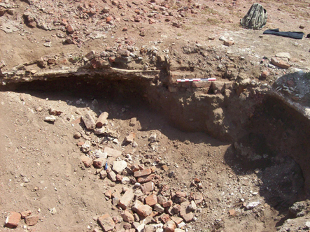
Pit dug into the tell, with brickwork, plates and pottery exposed (C. Malleson).
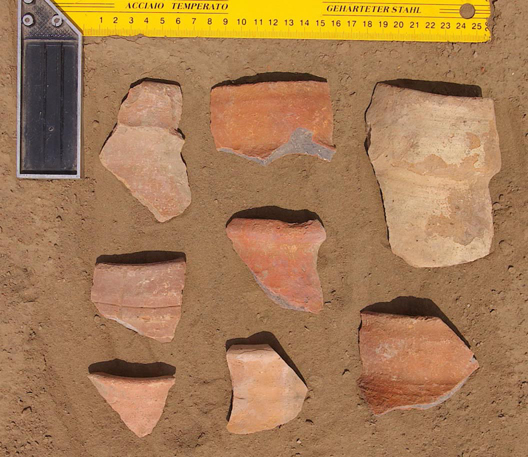
Above and below : Pottery typical of that collected from the pits.
In addition, some terracotta tile fragments were also noted and fragments of wall plaster or other architectural features.
Terracotta tile (M. Pesenti).
Fragment of moulded plaster (M. Pesenti).
The modern drainage ditches around the site also proved to be a fruitful place for the collection of pottery. When the ditches were dredged, the mud was piled up at the sides of the site and could be inspected by the survey team. The pottery material could have been washed down from the main site or reflect the deeper archaeological strata at the sides of the site. This, in turn, may suggest that the original extent of the site was much larger than it is at present.
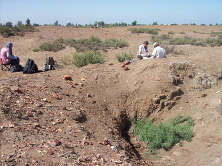
Surveyor in the ditch (C. Malleson).
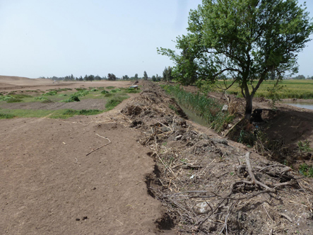
View of the ditch on the western side of the site.
Mud and pottery dredged out of the ditch.
2. Topographic Survey
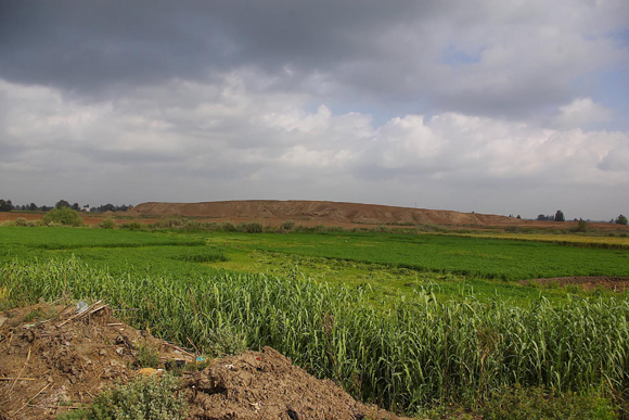
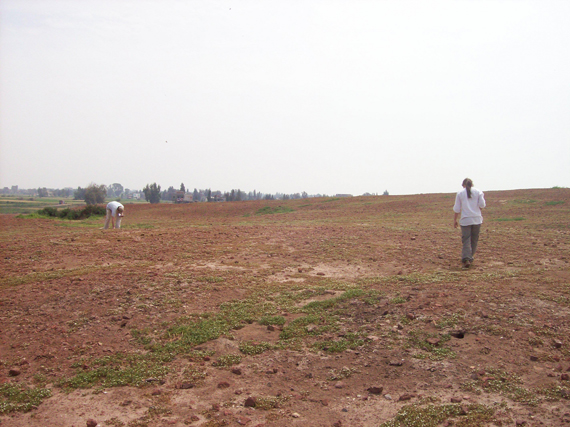
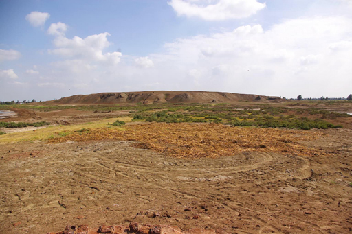
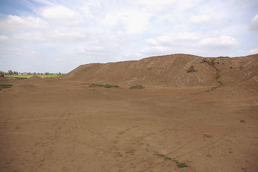
View of the Kom el Ahmar mound.
A complete and detailed topographic survey was carried out across the site in order to refine and improve the preliminary maps already made of the site. The maps also included visible features such as the fragments of the red brick structures at the site, traces of buildings and structures visible in the mud and plant growth, especially on the low, flat areas of the site, and any pits or sections dug around the site.
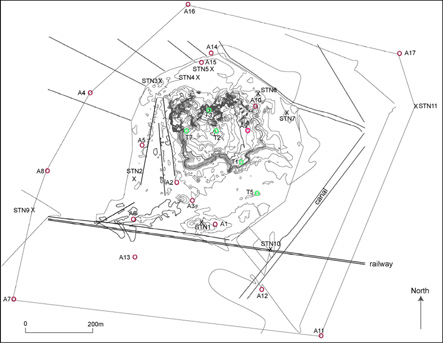
Map showing extent of topographic survey (Survey team).
Click image to view at full-size. (Requires PDF Viewer browser plug-in.)
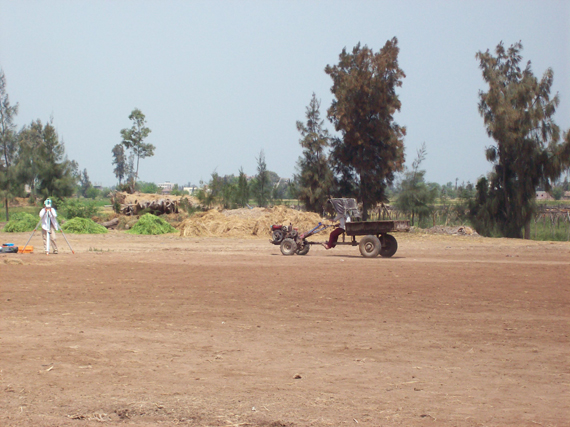
Surveying with a tractor and trailer going past (C. Malleson).
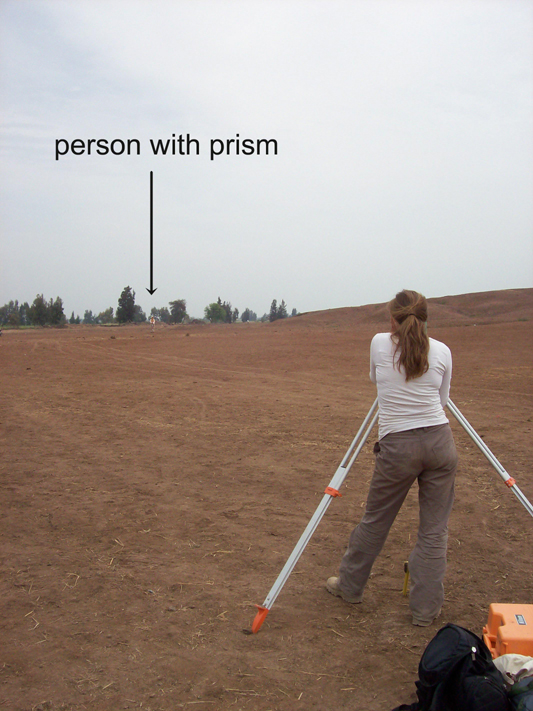
Looking for the prism from the Survey station (C. Malleson).
All of the survey points are noted on the map, moving around the site as the work proceeded (STN1 to STN 7). The red dots labelled A are the drill auger holes discussed below. The modern railway line dominates the southern part of the site and a canal lies to the east and around the edge of the mound.
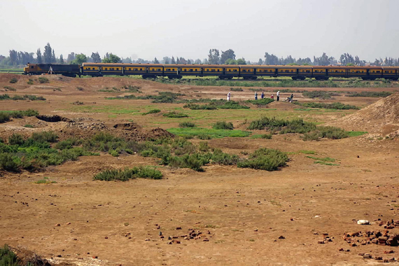
Train going past during the survey.
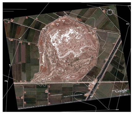
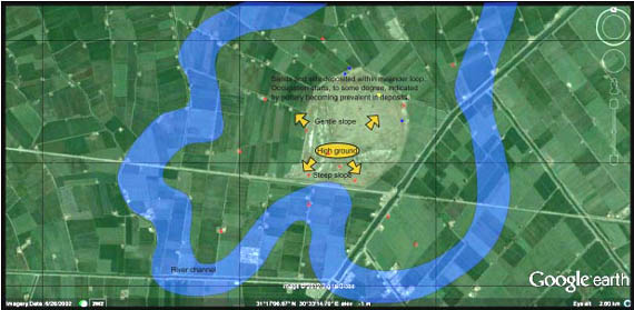
Satellite image (orthorectified) and map (Malleson, Pennington and Wilson).
The map was overlaid onto the orthorectified Googlearth (TM) satellite image in order to appreciate more fully, how the satellite image should be interpreted. The highest point of the mound about the surrounding fields was at 15m, but in fact the mound rises around 12m from the lower parts of the site. The area covered by the mound itself is 500 m from east to west, by 360 metres from north to south, but the whole site covers an area of 640 by 550 metres, being slightly elongated from north to south.
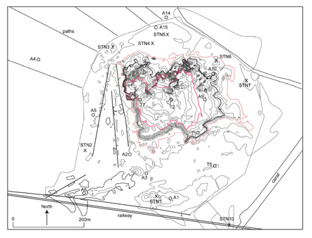
Map with the top of the mound and the base of the mound outlined in red to show the extent of the mound (Survey team).
Click image to view at full-size. (Requires PDF Viewer browser plug-in.)
The very close contour lines on the map reflect the steep sides on the south and west of the mound, while the more widely spaced contour lines show the sloping sides of the mound to the north and west. It is likely that the south side has been somewhat eaten into by illicit digging over the years, and the west side, too, may have been subjected to more intensive sebakh (mud brick) removal. The tracks of what seem to be a low railway embankment are clear, perhaps once part of a light railway line running into the site to remove the sebakh. It is possible though that this side represents the more monumental side of the site with large mud brick walls. It is this view of the site which makes it seem so imposing.
South side with cut out area containing a granite grindstone.
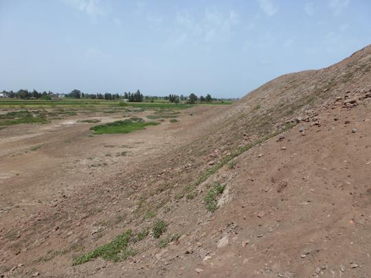
The steep sides of the west.
The flat area on the west with old sleeper embankments visible (C. Malleson).
Wall on the western side of the mound (C. Malleson).
The west and south sides of Tell Mutubis.
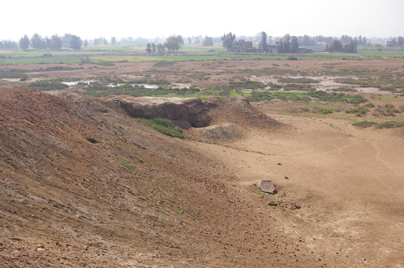
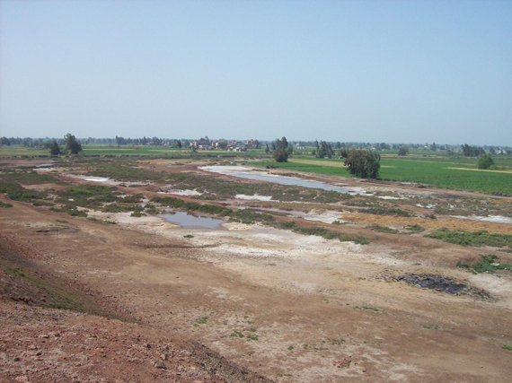
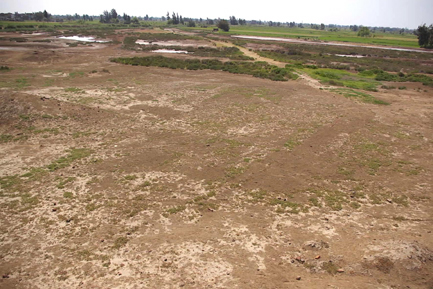
The northern and eastern sides of the site had many rain-cut gullies and some modern pitted areas.
Northside of the site from the top of the mound.
East side of the site with rain water gully, from the bottom of the mound.
In many places all over the site house and building plans were visible to the naked eye, suggesting that the superstructures had been removed and only the foundations of the walls were left behind. We plan to map there features more precisely using geophysical methods in the future.
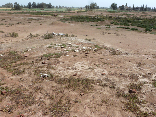
The pale brown patches show the edges of a large building.
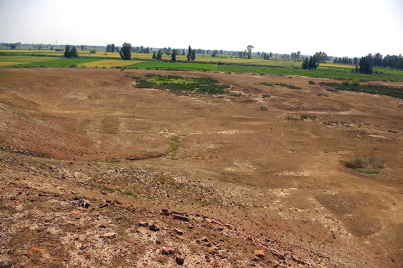
Looking down from the mound the pale stripes and the depression filled with vegetation betray the former locations of buildings.
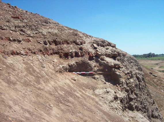
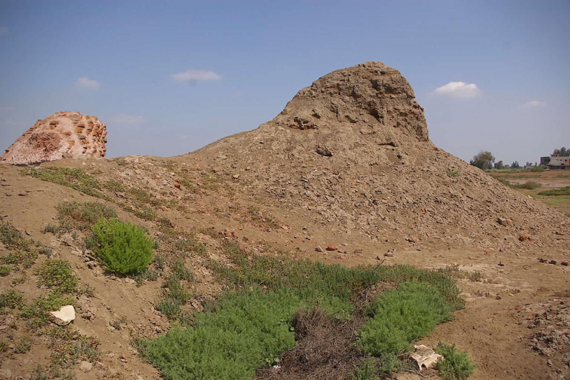
Where soil had been dug away some mudbrick remains were left standing, or red brick structures were also left at various places around the mound and flatter areas. They are particularly vulnerable to weathering and erosion, so we tried to record as many as possible. In one area, a number of limestone blocks also littered the sites and they may have been part of a stone building at one time or reused in a brick structure such as a church.
Mud and red brick fragments left standing.
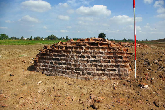
Red brick building. (Scale is 2m.)
Stone blocks on the site.
In many places there were straight sections created by natural erosion or pits created by modern digging. We were able to evaluate the stratigraphy in different parts of the site by examining, carefully, the sections. They were all quite crumbly, but often there was enough information to be able to see that there were multiple layers of activity at the site and some areas with substantial mud brick walls as well as compact domestic layers.
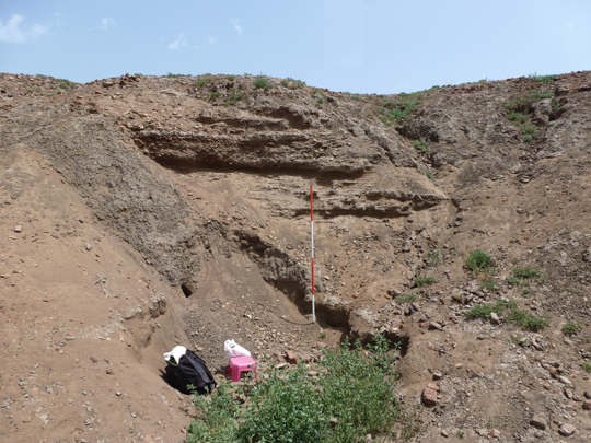
Section. (Scale 2m).
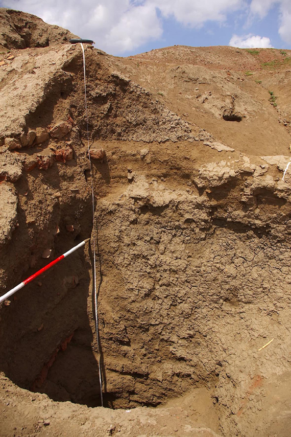
The above section shows about 4 metres of stratigraphy. Directly behind the ranging rod is mudbrick containing small pottery sherds, above it is a dense pottery filled layer and then a further mud brick and red brick layer above it. To the left of the photograph there is a solid mass of mud brick without any pottery. This suggests three distinct phases at least, but the size and continuation of the massive walls is perhaps significant.
Pit dug into the site.
This pit has been dug through a mud brick wall with red brick -strengthening course. It descends for around 3-4 m into the mound and then turns to continue horizontally inside the mound. It shows how dangerous is illicit digging and the pit will slowly erode so that another part of the site is lost.
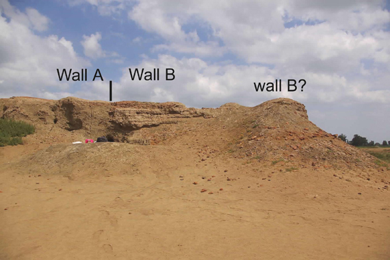
Two walls, apparently abutting.
The section shows a mud brick wall with little pottery and a red brick structure on top of it to the left. It adjoins a Wall B which is made of mud brick with red brick course and has dense pottery filled brickwork on top of it. The stump of mud brick to the right may be part of wall B originally.
The combination of large mud brick and reinforced walls, together with the smaller house plans and the larger buildings, suggested that the local tradition that Kom el Ahmar was some kind of fortified city may have some validity. It may have controlled access to the river and the nearby lake as well as the surrounding countryside.
3. Archaeobotanical sampling
There was a programme of selected sampling of material from domestic contexts recorded in pits or holes already dug on the site. This was intended to demonstrate the potential for understanding the types of plants around the site as well as those within the site which may have been used for food, as silage or occurred naturally within the town.
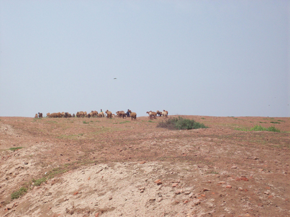
Modern sheep grazing on the tell (C. Malleson).
Report by Claire Malleson
Two samples were taken from different stratigraphic levels from within one of the pits dug on the site. Sample one came from a whiter ashy layer, Sample two from a lower, black ash layer. The two samples were processed by bucket flotation on-site, material collected in a 300_m mesh and examined under a binocular microscope at x7-20 magnification.
Samples one and two both contained wood charcoal, cereal grains (wheat and barley) and chaff, and seeds of cereal crop contaminant weed species – wild grasses, clover (bersim), rushes and reeds, as well as some seeds of fruits and other food crops (fig, possibly juniper).
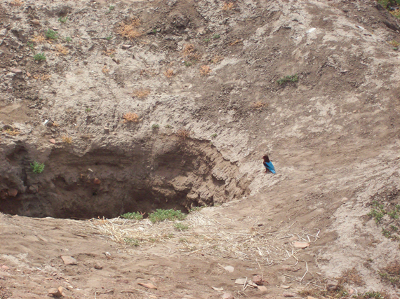
Bee-eater examining the layers in a pit. These layers are softer than the hardened top of the mound and ideal fro nesting burrows for the birds.
The material is typical of household waste, and is suggestive of a domestic dump. The samples contained a mix of burned (charred) and desiccated cereal crop processing waste and food waste (plant foods and some fish) – charred material representing oven and hearth fuel cleared out and dumped with general household waste. Whilst some of the species of plant present were utilised as animal fodder in ancient Egypt, there was no direct evidence of this in these samples as there was no clear evidence for animal dung, suggesting that the species present were all a result of cereal crop processing waste used as fuel, and human food-waste.
Modern specimens were collected from around the site to act as a reference collection for probable sample contaminants.
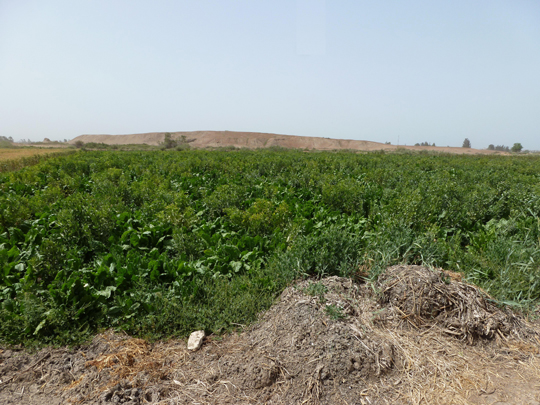
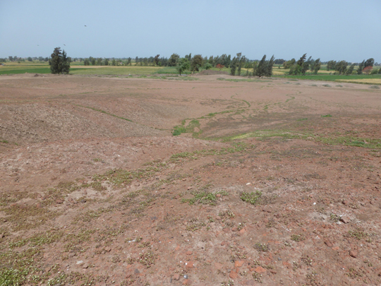
Field nearby the site with leafy green crops.
4 Drill auger survey
The drill augers were intended to collect data concerning the landscape around the settled site in order to reconstruct the evolution of the landscapes and the development of the area. It is possible that the ‘Rosetta’ channel ran closer to the site than it does now and that there were marshy inlets on the south-east side of the tell. In addition the drill auger survey was also intended to discover the subsurface topography of the tell and whether it was founded upon a levee or sand hill. Furthermore the drill could also give information about the stratigraphic layers of the layers of the site by completing one auger hole on top of the site.
Drilling team in action.
Report by Benjamin Pennington:
Using an Eijelkamp hand auger, seventeen holes were drilled in the area on and around Tell Mutubis in order to begin to reconstruct the historical landscape around the site. The holes were located along two transects, one in a broadly SW-NE direction, and the other approximately SE-NW. Single holes were drilled to the North, the South and the West to provide corroborating information. The position of each hole was surveyed within the local grid system (x, y, z), and its location geo-referenced via handheld GPS.
Sediments recovered during the boring were analysed and recorded in the field in terms of grain size, clast percentage and composition, organic content and form, as well as sorting; rounding, and mineralogy where appropriate. Well-preserved sherd material was removed and bagged to be described and interpreted by ceramicists. Three of the auger cores were of limited use, as the drill encountered material too stiff to penetrate at depths of less than 2m below the ground surface, but the other fourteen reached greater depths and were useful in building up a picture of the palaeo-landscape.
A preliminary interpretation of the data reveals the presence of a pre-occupation river channel, possibly aligned N-S, located to the west of the Tell. Contemporary to this channel but further to the east, the sediments are very organic-rich in places, and are likely indicative of a swampy environment. Abandonment of this western channel is followed by a period of very fine grained floodplain deposition, after which the presence of another river channel is detected (possibly aligned approx. E-W) to the south of the site. It seems plausible that it was upon the levees of this river that a Roman settlement was built on the site of the Tell. More recent abandonment of the river channel was subsequently followed by modern floodplain alluvial deposition.
Reconstruction of the second phase of the river channel in the area of the site, whose levees formed the solid base of the site in the Roman period (B. Pennington).
5 Summary
The results of the survey show that Kom el Ahmar (Mutubis) was a substantial Late Roman town, which seems to have expanded over a period of perhaps four hundred years from a core settlement out towards the current limits of the site area. There may have been an earlier phase of settlement in the area, perhaps as early as the Ptolemaic period, which formed the basis for the later settlement. Most of the dated material noted at the site is from the Middle to Late Roman period, that is around 300 to 700 AD and some few fragments of possible Islamic material were also noted, that is from the 7th century onward. The substantial mud bricks suggest that there could have been some walled areas of the town, particularly n the western side. It would be natural that there should have been at least one church here in antiquity and perhaps some bathhouses or other hydraulic features as suggested by the red brick structures.
At the abandonment of the site some time after the Arab expansion into Egypt, the reduced population of the city may have moved closer to the river and the modern city of Mutubas.
Although the current site area does not seem to have been affected too much by erosion at the sides (except perhaps on the south-eastern side), some parts of the mound on the southern and western sides seem to have been removed in part.
Further work will enable us to plan different zones of building at the site and refine our pottery as well as the glass corpus.
View from the top of the mound towards modern Mutubas.
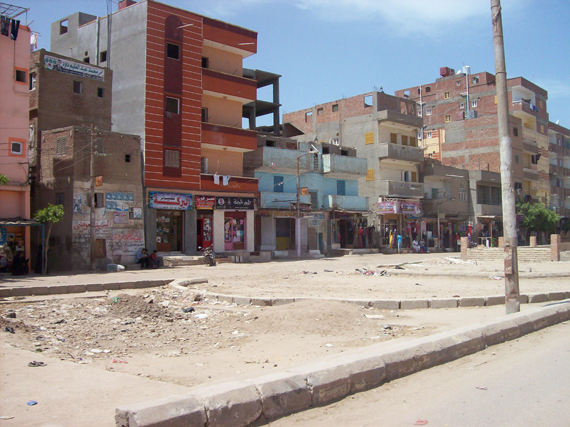
The city of Mutubas (C. Malleson).
Thanks to the whole team: Claire Malleson, Rebecca Bradshaw, Ashley Hayes, Fatma Keshk, Mikaël Pesenti, Aude Simony and Hind Ramadan, as well as the local police, Tourist Police and MSA office in Kafr el Sheikh under Dr Mohammed abd el Rifaa.
Shem el Nessim eggs made by the Team (C. Malleson).
Time to go home (C. Malleson).