Saïs Survey Report, 1998
The team comprised Dr Penny Wilson (Director), Dr Mark Noel and Mr Duncan Hale (GeoQuest archaeo-magnetometrists), Dr François Leclère (IFAO epigrapher) with Dr Magdy Ismail representing the SCA and was in the field from October 5th to 22nd 1998. I would also like to thank Dr Sabri Taha Hasnein, the Chief Inspector at Tanta and Ms Fatma Ragab Kamil who both gave tremendous help and encouragement to the mission.
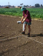
Over a period of two weeks a geophysical survey using a magnetometer was carried out at selected areas around the site.
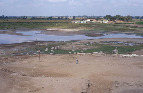
In general, we concentrated on the agricultural areas of the site because the area designated as Antiquities land in the Rebwa Basin was too uneven and hillocky and the land in the ‘Great Pit’ had been dug out too much in the past and was therefore too disturbed to give meaningful results over small areas.
The choice of agricultural land was dictated in turn by the availability of fields without crops or standing water. As much of the agricultural land was planted with cotton bushes or under rice not due to be harvested for two weeks we had to seize the opportunities for field work as they appeared.
The weather was also unseasonably hot, which made working conditions difficult for the geophyicists.(1)
Nevertheless, we had good results in three areas :
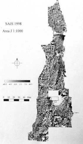
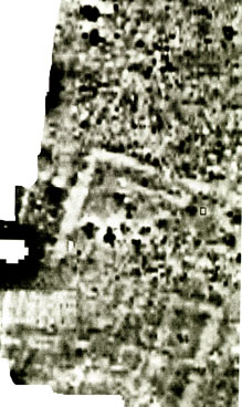
- Area J (right) : a strip of land running along the east side of the ‘Great Pit’ which shows structures on the surface, about 30 metres by 350 metres total area. Preliminary results of the magnetometer survey suggested that there is a line of cell-like stone structures arranged along roads running in a north-south orientation under this area. The results complemented the observed surface features, but there was much background noise because of pottery, burnt brick and modern rubbish.
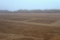
- Area B : a cleared field and bursim field at a point perhaps in the southern entrance through the Enclosure wall in the Rebwa Basin area. Anomalies here suggest that there is a large filled ditch or robbed trench and possible stone structures under the fields.
- Area M (right) : a cleared field to the south of the Sheikh Shaheen farmstead. Analysis of the data suggests that under the field there is a large stone building, with walls approximately 4 metres thick and surviving as the corner right angle of a building with walls about 20 m and 30 m long, several smaller stone buildings and some possible kiln sites.
In the plate the vivid dark area to the west is an electricity pylon. The date(s) of these buildings are not known but this does suggest that in the otherwise ‘empty’ area between the Great Pit and Enclosure there is archaeological material under the agricultural land.
Other test areas and fields: areas E and H in the base of the ‘Great Pit’; area L to the west side of the Enclosure to see if a mud brick wall could be differentiated from mud run-off; area M a mud bank with surface colour changes in the Rebwa Basin; area K cleared fields to the east.
Dr François Leclère copied all the inscribed blocks at the site in the SCA Office/Police Station. This amounted to a good corpus of about 25 blocks.
With the help and co-operation of the inspectors at Tanta he began work looking at the registers and archives in the Antiquities Office in Tanta for further information about the provenance of the various blocks. It seems that some were originally found in the village of Sa el Hagar, while others have come from further afield.
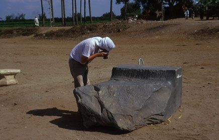
Penny Wilson planned and recorded parts of the mud brick structures in the south western corner of the Great Pit, excavated by the SCA/EAO in recent years. These structures link in with the geophysical survey. She also planned the limestone blocks (plan) at the south end of the ‘Great Pit’, which seem to be the last remnants of some monumental stone building, perhaps also oriented on a north-south axis (below).
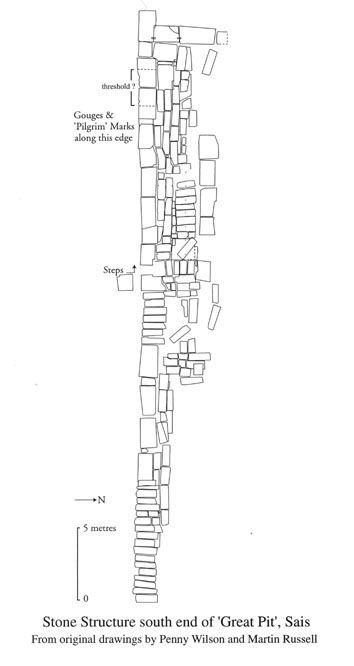
Some of the blocks are massive precluding the possibility that they are part of a drainage system for the nearby Roman bathhouse. The remaining section of wall has been freed to a depth of four courses at its western end and the blocks seem to be arranged with massive rectangular blocks laid end to end, alternating with smaller regular blocks laid side by side. At one point there is a gap in the stone structure, seemingly a narrow entrance leading to a flight of steps, with a sharp right angled turn west and continuing inside the stone structure. Towards the west end, the front of the wall has some ‘pilgrim gouges’ and there are depressions in the remaining top stones where powder might have been ground out from the stone. On two massive blocks there is a shallow cut and between the grooves here there is a greater number of ‘gouges’. In addition, some of the blocks also have rectangular or square cuts made at the corners.
At first it seemed this may have been the last remnants of the front of a temple building and, in particular, the east side of the foundation wall of a pylon with a threshold for the gateway. The length of the structure is, however, approximately 76 metres and there are indications that it continues to the east and west. Unless it is a huge pylon base matching and perhaps exceeding the Karnak structures, it may then be the side wall of a temple or a stone foundation for an enclosure or some other type of building. Just to the north inside the Great Pit is a group of large granite blocks, possibly in their original relative position because the underlying ground has been dug or washed away. If they are related to the limestone blocks they could have come from the same structure. They could have formed part of a formal layout of the whole site, with a strong south-north axis linking the temple structures in the south (now the Great Pit), with the earlier (?) Enclosure in the north and its north-south aligned temples. This would fit the alignment of some of the building traces reported by Wilkinson in 1821, but does not preclude the existence of other east-west aligned buildings or peripteral temples in the Enclosure.
We obtained copies of the detailed cadastral survey maps for the Sa el Hagar area up to the river, a total of 18 sheets. They provide the correct names for all the fields in the area.
I am very grateful to Dr Noel and Mr Hale for their forbearance and advice in difficult conditions.