Mutubis2014
Mutubis in 2014
Introduction
I was only able to make a short visit to Tell Mutubis in 2013 on the company of Prof Hosni Ghazala to discuss the prospects for resistivity work (that is using electrical probes to determine sub-surface features), for the geophysical survey using gradiometers (that is detecting changes in the magnetic susceptibility of the site in order to determine what lay under it) and for wider environmental Vertical Electical Surveys in the area in order to begin to reconstruct the wider environment over time. Plans to carry out the work came to nothing because of the political events in the summer of 2013 which meant that no work was possible.
In 2014, however, with permissions in place and security approval we arrived aiming to try to get inside the tell at Kom el Ahmar without having to use a trowel – at last. I felt that I had waited a long time to get to this stage, since 1999, in fact. Thanks to the Amelia Edwards Funding from the EES we were at last about to make some progress.
A blog was kept for the season and you can access the posts here:
Wilson in 1999 (above) and in 2014 (below);.
Mutubis in 1999
Mutubis in 2014
The team in March and April consisted of
Dr Penelope Wilson (Field Director), Prof. Hosni Ghazala and Mahmoud Mahmoud (Geophysics, Mansoura University), Dr Daniela Rosenow (UCL, London) George Wing, James Bennett, Benjamin Hinson, Sara Mohamed Eid Seif el Din for the MSA. The training Inspectors at Mutubis were Fathy Abu Saadun, Khaled Moustafa, Noha Gamal Abd el Haq. We would like to thank Mr Gamal Selim in the Kafr el Sheikh office, Dr Hossam at Tell Farain and Dr Mohamed abd el Rifaa in Tanta, Dr Mohamed Ismail and Hani Abu el Azam in Cairo. Funding was provided by the Amelia Edwards Fund of the Egypt Exploration Society, the British Academy International Partnership & Mobility Scheme. We are grateful to Essam Nagy in the EES Cairo Office, as well as to the police and security in Tanta, Sa el Hagar and Mutubis.
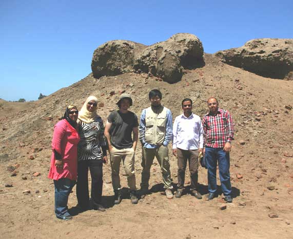
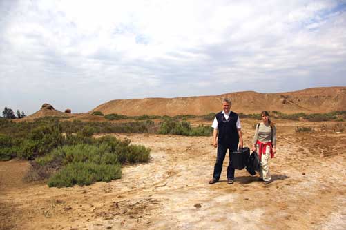
Team Photo
Work at Tell Mutubis (Kom el Ahmar)
The work took place from 29th March to 20th April 2014.
1.1 Introduction
The previous work in 2012 completed a map of the site, showing the contours and dimensions of the archaeological area. Briefly, the site comprises a mound up to 15m above the surrounding field level, which has two steep sides on the west and south side and more gently sloping sides on the north and east. The northern side has many gullies and separate small mounds, while the eastern side has darker coloured earth and building plans visible in the lower levels. The pottery corpus, compiled as part of this work, confirmed the date of the site to predominantly the 4th-7th century AD, that is the Late Antique period. There was virtually no evidence for anything from the Islamic period or indeed, from earlier Roman and Ptolemaic times. Only one pottery sherd was found which could have a late Ptolemaic date. The Cairo Museum, however, does have some coins from the site which have been dated to the Ptolemaic period.
1.2 Aims and Objectives of the Work
• To continue the survey and recording of features and strata on the site begun in 2012;
• To undertake a pottery and material culture sampling survey;
• To undertake the study of glass at the site;
• To carry out magnetometry using a fluxgate gradiometer in selected areas;
• To carry out an electrical resistivity survey in the same areas;
• To carry out Vertical Electrical Soundings in the areas around the site.
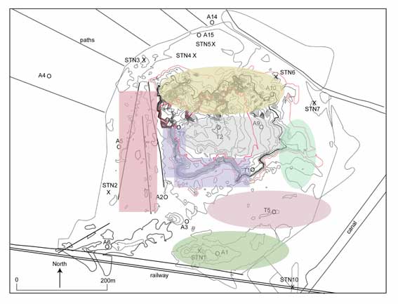
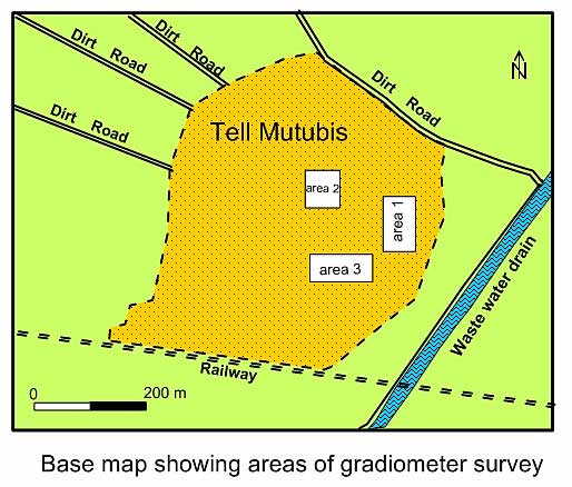
Map of Tell Mutubis-Kom el Ahmar completed in 2012 with zones of interest marked in different colours: pink – destroyed areas; purple – walls?; grey -buildings; green – kilns; yellow – eroded structures..
1.3 Features Recorded in 2014
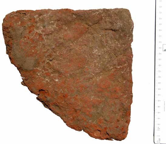
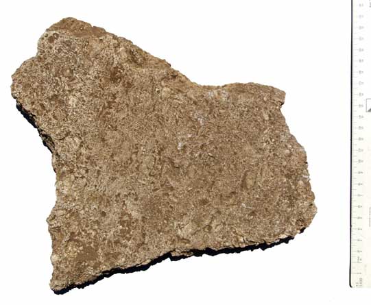
a) ‘Church’ building. An area on the south side of the mound was studied in order to understand the nature of the structure uncovered. A hole had been dug through the floor of a building. The floor consisted of a mud foundation, with a mortar and limestone tile surface. The limestone was shelly limestone, perhaps from the north coast of Egypt. Each tile had been smoothed and then set into the mortar. There also seemed to be an area with red bricks creating a solid foundation through the floor, perhaps for a column base. This seemed to be confirmed by the finding of a set of quarter-circle tiles made of fired coarse Nile silt, whose dimensions matched 3 limestone columns found in the area. The columns were between 35-38 cm in diameter and the pottery base 41 cm in width. The column may have been displaced from the base. In total, eleven other stone fragments were near this feature and they were recorded, suggesting that the structure had been partly built of stone, with columns hence our identification as a church. No ground plan could be seen, however, and the structure would require excavation to ascertain its form and function. Further pottery was recovered from this area and recorded for the corpus.
Evidence : section through floor.
Evidence : column shaft.
.
Evidence : column base.
.
Evidence : limestone tiles.
.
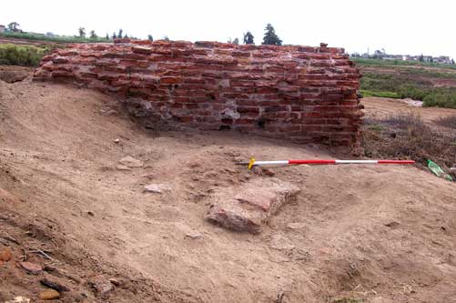
b) Sections of the steep parts of the mound were also recorded by planning the sides of the mound, the collection and recording of pottery and comparison with other open sections. These small areas confirmed that on the west side there were substantial mud brick ramparts built of layers of mud brick, strengthened with interleaving layers of red fired-brick. It is still unclear, however, whether they represent a circuit wall around the west and southern sides of the settlement, rather like a defensive citadel; or whether the a false impression has been created by sebakhin digging leaving these prominent steep sides. Even if the features are not a continuous wall, they still belonged to substantial mud brick structures of some height and may then be compared to tower houses..
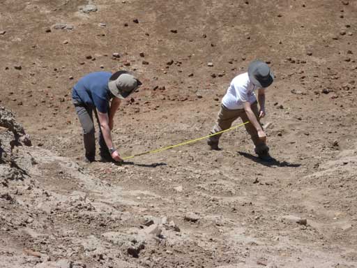
Working on the steep ‘ramparts’.
.
Open sections on the perimeter of the site also allowed us to obtain information about the underlying stratigraphy of the site.
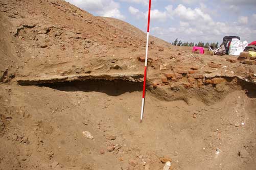
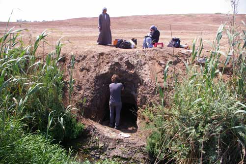
A 2m section had been cleared on the north-eastern side and then undercut into the site. The strata here showed that the sequence of alluvium, a thin layer of smashed pottery and brick and then a further covering of alluvium probably showed a virgin foundation on alluvial silt, at this point of the site, perhaps not densely occupied and for only a short time; then once abandoned the outer limits of the site were flooded annually creating the further alluvial layers. This would mean that the main mound was at least another 1 m above the surrounding fields in antiquity, even without its actual structures.
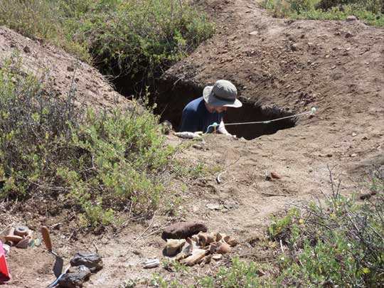
Ben down the ditch.
A 2m long and 1.5 m deep hole on the southern part of the site also had pottery buried underneath alluvial deposits and they in turn lay upon alluvium, as far as could be detected. All of the pottery from these levels was of Late Antique date.
BBen down another hole..
c) A structure in the flat area on the western side of the site consisted of a red-brick rectangular feature, 3.5m by 1m, which had been built on top of pottery filled earth. Investigation of the material that had been removed from inside the feature suggested that it had had a brick roof, suggesting that it was a cistern of grave of some kind. It was not possible to confirm this as no bones were found in the material removed from inside the feature. The pottery from under the ‘grave’ was quite coarse and also consisted of amphorae. They appeared to be Roman in date, but a coin perhaps also from this feature, looked as if it might be Ptolemaic in date, and this remains to be confirmed.
Related to this feature, there were other red-brick walls visible on the surface once the low growing bushes had been removed. These seemed to have white washed interior walls, but it was not clear how old they and whether they related to the main phases of the city.
‘Grave’ areas or tanks?
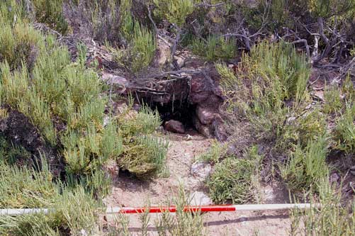
d) The tanks on the western side of the mound came within one of the pottery sampling circles and when the circle was cleared, a further fragment of red brick wall was noted. This feature was circular and there is a possibility that it could be the tholos (circular bathing room) of a bath-house. Together with the tanks with their heavy plaster and water-proof mortar, this also confirms a bath house was here. Some of the walls are left, but it looks as if the structure had been destroyed in the past and, perhaps, only foundations would be left.
Cleaned area next to tank showing tholos – from a bath-house.
e) Three stone fragments were recorded on the site:
1) a large piece of red granite, perhaps part of a grindstone, was lying over-turned on the western side. Dimensions: 1m long x 90cm wide, maximum thickness ca. 20cm. This may be part of the grindstone noted at the site in 2001.
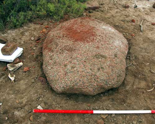
Granite.
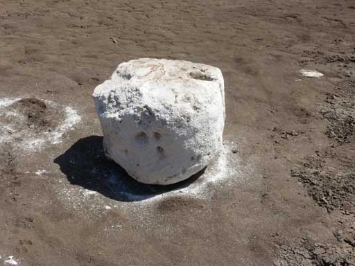
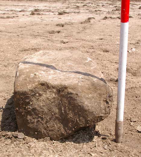
2) a large limestone block, partly buried in mud was cleared and measured. It has some evidence of working with one smoothed and rounded side.
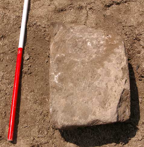
View of block from above and (below) from the side.
3) a number of fragments of volcanic stone that were used as grindstones. The stone is black with white particles and has a very abrasive surface. One lozenge shaped grinder was noted and one circular rim of a quern or V-shaped grinder was also measured. The stone probably originated in Italy or Sardinia.
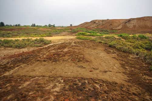
f) On foggy or misty days new building plans often became clear on the ground surface due to the moisture in the atmosphere and the slow rate of drying compared to other types of soil. A rectangular/circular feature was seen on top of the tell and building plans were very obvious on the flatter parts of the site.
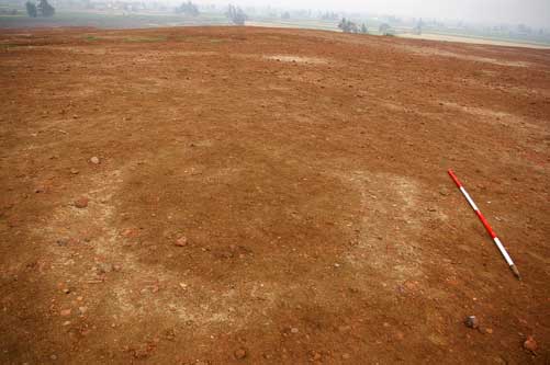
Circle.
Building.
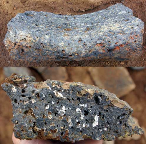
Volcanic tufa used for grinding stones.
1.4 Pottery and Material Culture Sampling Survey
The aim of this survey was to begin to detect differences in the densities of material culture across the site in order to define zones of activity, particular types of building or potential areas for future excavation. A grid was laid out with the highest point on the main mound as the origin and east-west and north-south transects were laid out from the centre. Points were placed every 50 metres along the transects. Then further transects were laid out intersecting the N-S and E-W lines in order to divide up the mound into north-east, south-east, north-west and south-west sectors. Later, intermediary points were put at 25m along the transects in order to improve the coverage of the grid in the most densely covered areas.
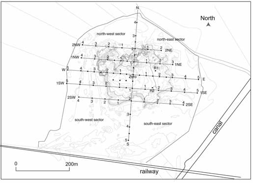
The sampling grid across the site.
Click image to view at full-size (requires PDF Viewer browser plug-in).
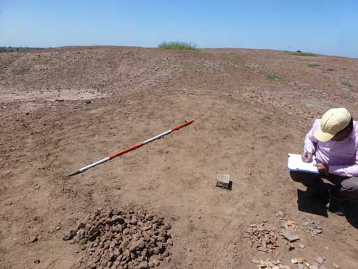
At each point a 2m radius circle was drawn out. Everything within the 4m diameter circle was collected, sorted according to material type and pottery fabric (mainly based on colour), then counted and recorded.
Cleared circle.
Information from each circle was then entered into a spreadsheet for mapping onto the site plan. In this way patterns and densities of certain kinds of material might prove to be significant.
In all, a total of 79 circles were sampled, including a final ‘random’ sample. These circle areas were chosen on the basis of visible surface material and thus were potentially ‘interesting’ areas. The problem of bias on the part of the samplers was offset by the systematic grid survey, so that the combination of the two should give a relatively balanced coverage of the mound.
Piles of stuff and counting.
Results
The main results of this survey highlighted the fact there were different zones of activity on the site, suggested by the different types of material culture. The main material type found on the surface was fired red brick, usually in fragments between 5cm and 10cm in size. After this pottery of all kinds was most common.
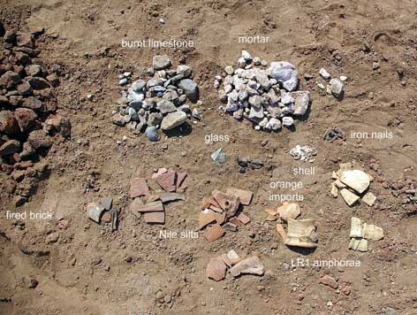
Types of finds
There were some differences in distribution of all materials across the site.
For example, concentrations of burnt limestone (as above) suggested that stone used in constructions had been taken in antiquity and reduced by burning to make lime. This, in turn ,suggests that at the abandonment of the site it was used to some extent as a quarry for limestone. Some of the vitrified brick, especially on the western side of the site could therefore have been associated with lime production at some time after the abandonment of the site.
In general terms, on the eastern and especially south-eastern side of the site there was good evidence for high temperature operations, either as part of a manufacturing or destruction process. Highly vitrified brick, in conjunction with pale coloured slag and many glass fragments suggested that this was a glass manufacture (melting and making) area. For example, the rampart areas and edges of the mound producing least and the eastern industrial areas producing most fragments.
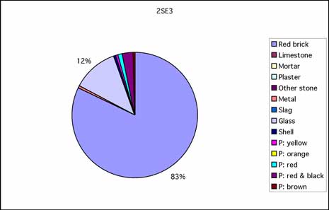
2SE3, with vitrified red-brick and glass as the highest components, as well as slag..
The main mound showed areas of dense occupation separated by areas of mud. This suggested that the ‘red’ areas were the internal fill of rooms, while the mud areas were the walls of the rooms, having eroded at a faster rate than the internal fill. For example, at the Zero point and very centre of the grid there was little material as this was a dry, muddy-area; whereas, just 50m to the west there was double the amount of red brick and much more pottery, in a high density area, suggesting that this area was ‘inside’ a structure. It is possible that red brick was used as flooring hence its presence inside buildings.
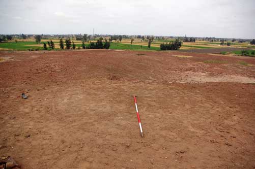
Zero top of the mound with ‘patches’.
Some areas (E25m and Random 1) had concentrations of mortar and in 1NW1 there was a large amount of white plaster (Figure 3). This must have come from the internal parts of structures. The mortar was characteristic ‘Roman’ mortar with fragments of red brick or pot in it and a distinctive pink colour. The plaster was made from fine, white gypsum but no colour was found on it. In Random area 1, four iron nails were also found which may indicate a partly wooden or roofed structure stood here; while in 1NW1 and 2SW2 the numerous mortar/plaster fragments also suggest the internal apartments of a well-appointed building.
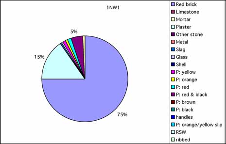
1NW1 material: the largest part is red brick; the 2nd largest plaster fragments; the third largest is red & black amphora sherds.
Pottery circles from the side of the mound, especially on the west and south, where there appear to be hug ramparts, tended to suggest that some of the pottery had been used in the construction of the walls. Some evidence for AE3 amphorae and very worn and eroded sherds were found in the material collected from these areas. This may represent earlier dismantled or ruined areas, which were utilised as a source of brick in later Roman times. All of this material seems to be have been reused and then deposited once it had eroded out of the mud-brick walls.
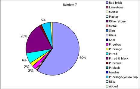
Random 7 on the side of the ‘rampart’: the largest segments in descending order are – fired brick; red & black amphorae; Nile silts; orange with yellow slip.
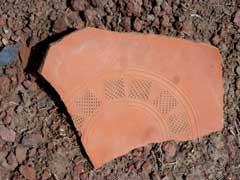
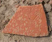
The most noticeable types of pottery were Nile silts, but pottery with red edge and black core was extremely common, perhaps from amphorae made from Nile silt and fired in a reducing atmosphere. Over 700 sherds were recovered from 2SE1 suggesting a rubbish dump, whereas in other places up to 130-150 fragments were recorded (2NE1, 1SE2). This suggests the fabric was brittle, shattering into splinters. Yellow amphora sherds from Late Roman 1 amphora in three distinct fabrics were notable amongst the imported amphorae (the highest concentration in N1), along with some orange fabrics perhaps from the Aegean and one rare but interesting bright orange fabric with a thick black slip on the outside and inside. The finewares consisted mostly of imitation African red slipwares or Cypriot Red slip wares and some had embossed decoration, including one sherd with a heart design, one with a chequer-board lattice and one with palm fronds. Many of these fragments were just splinters of pottery, as it had suffered from wear and the salty earth.
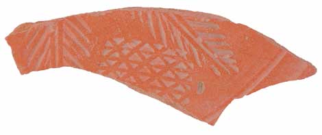
Pottery types; decorated sherds showing impressed palm (above), squares and heart (below).
A few corroded coins were found in circles and in various places on the site, including once possible early Roman coin; one showing a caduceus design (perhaps time of Hadrian or Trajan); one smaller coin with a Byzantine cross on it; and one disk marked with the letter S. Some small round objects seemed to be double disks and may have been buttons or studs for the decoration of clothing. In another area, a key-ring was logged as well as iron nails, which may have come from roofing.
Everything was recorded and the circles photographed for reference.
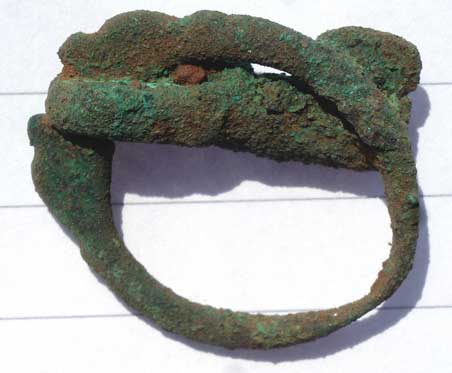
Corroded key-ring.
1.5 Glass study
Daniela Rosenow carried out a study and analysis of glass collected at the site in the circle-survey and also noted by her personally. Several types of glass were noted, including colourless glass with high manganese content, compared to green-blue glasses with high natron content. The types of vessels represented consisted of oval bowls or dishes, small V-shaped lamps, cups and bowls, some jugs and bottles. In addition, several pieces of slag at the site, a light-green colour may have come from glass manufacturing and some glass fragments with signs of re-melting were also found, again suggesting making and recycling of glass as a primary part of industrial production at the site. Furthermore, some decorated examples were found with bands around the vessels or with extra glass applied to the surface as a chain-decorative pattern.
Daniela and Prof Thilo Rehren visiting the site
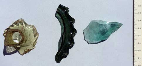
Glass.
1.6 Magnetometer Survey
Three areas were tested for magnetic susceptibility using a fluxgate gradiometer. They measured 60m x 40m. A further area was tested in September consisting of four grids of 20m by 20m to the south of the mound. In all, just under one hectare was covered in the time available. The magnetometer measures magnetic resistance, which is caused by materials that have been fired to a high temperature, for example red brick or even concentrations of pottery as well as igneous rocks such as granite. These areas show as black on the image. By contrast with those areas it thus also shows areas of low resistance such as limestone, mud brick (to some extent) and soils, which have not been disturbed. These show as grey to white on the image. The areas all showed interesting results:
Locations of areas
Area 1 – East side of the mound on sloping: a strong linear feature was detected in this area running roughly north-south, and this feature was not visible on the surface. In addition, there were several areas of high resistance but small in size. The plans of small square structures were also visible, as well as some circular features.
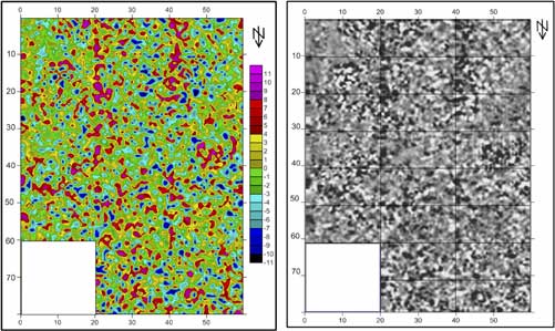
Magnetometer Area 1.
Area 2 – Top of the mound. This area was extremely ‘noisy’, as was borne out by the large amounts of red brick and pottery lying on the surface and potentially under the ground. Nevertheless, after data-processing and cleaning, a number of features could be seen, including a large rectangular building with internal hemispherical features; smaller circular structures as well as a long linear feature running through the area.
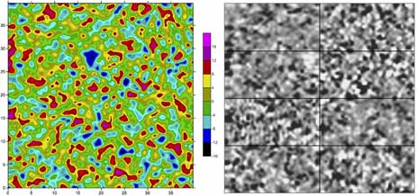
Magnetometer Area 2.
Area 3 – South-east side of mound where it was flat, with saline mud and bushes. The area appeared to be relatively empty of archaeological material, except some area of high resistivity perhaps related to burning.
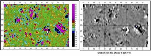
Magnetometer Area 3.
Area 4 to the south of the mound showed the corner of a building very clearly, a feature which was also visible on the surface. This was useful in confirming that the mud brick structures at Mutubis could be detected using the gradiometer.
Overall, the work showed that despite the high density of fired material lying on the surface of the site, it was still possible to detect underlying structural features and other areas of destruction. The data still needs much processing and filtering, of course.
1.7 Electrical resistivity survey.
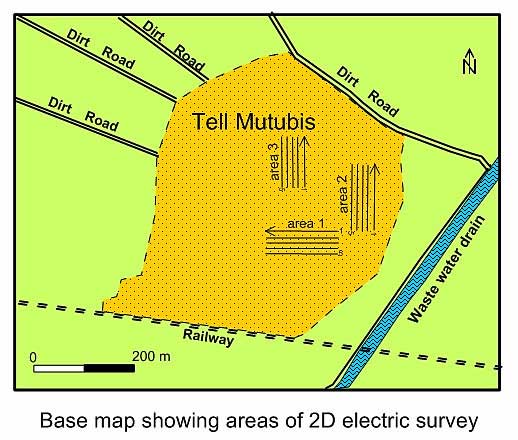
Resistivity Areas.
The resistivity surface was carried out in three of the same areas surveyed with the gradiometer (Figure 10) in order to compare and correlate the results. Despite the high salinity of the soil in the low lying areas of the site, it was possible to reach a depth of around 10m in Area 1, and 5-6 m on the top of the mound. The results are however, still be processed and have not yet be compared in detail to the magnetometer data. It is hoped that once the two datasets are brought together, they will be able to show the layers of sub-surface features so that informed decisions about any future excavation work can be made.
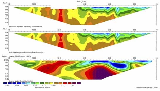
Area 1 Profile 1.
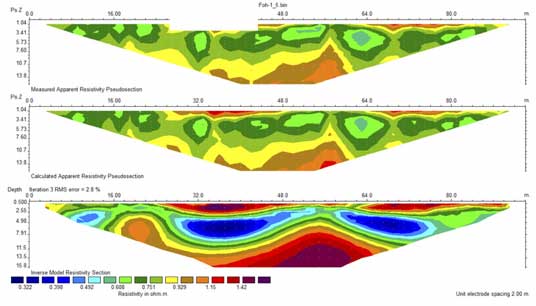
Area 2 Profile 1.
1.8 Vertical Electrical Soundings in the areas around the site.
Two transects of VESs were made in the fields around the site in order to gather information about the surrounding palaeotopography, to detect earlier river channels and to create a wider map of the changing landscapes at Tell Mutubis. The data will be compared with information from drill-augers carried out in 2012 in order to complete the picture of the environment around the tell in antiquity. The preliminary data from work by Ben Pennington in 2012 shows an early phase of the landscape with the site positioned between a river branch to the west and marshy areas to the east; and a later situation perhaps contemporary with the main occupation levels of the site with Mutubis located in a favourable bend in the river channel. The ongoing analysis of the VES work will add further detail to the environmental data, but Prof Ghazala wasn’t happy with the preliminary results so more work is needed!
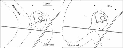
Ben Pennington’s preliminary interpretations and area of VESs marked.
Summary
The work in 2014 has resulted in a good understanding of the different functional zones of the site and the kinds of material culture that one could expect to find within the buildings and structures on the site. The tell has been much robbed in the past perhaps during the medieval period, when limestone and hardstones were quarried from the site causing the disintegration of some of the buildings. Nevertheless, significant structural elements still remain, even in the upper levels, as well as into the core of the mound for at least a depth of 7m. Part of the site may have been given over to the glass production on the east, and there were almost certainly pottery kilns as evidenced by the wasters from the site.
The large rampart walls on the western and southern sides may have continued around on the eastern and northern side. A large linear feature running north to south in the magnetometer Area 1 may be the remains of this wall on that side. Gullies on the western, southern and northern side may represent access points to the areas within the walls. The appearance of Mutubis must have been almost that of a citadel (Qasr) dominating the surrounding landscape and perhaps monitoring river and lake traffic. The final date of the site is likely to be in the 8th century, when the inhabitants moved away, possibly displaced to the core of Fuwa and ‘new’ Mutubis.
It is possible that the limestone paved building on the south side was a church or other significant building and that the tank on the west was certainly part of a bath-house. The church would be significant as the only confirmed ancient church in the north of Egypt (excepting monastic sites and perhaps the building at Qabrit).
The glass and pottery show that Mutubis was well integrated into the trading and economic networks of the eastern Mediterranean from the 4th-7th century and that its inhabitants enjoyed imported wine and oil as well as imitation red-slip finewares and glass made locally, but also sourced from the Levant.
Mutubis may have taken advantage of its mid-way position on the Bolbitine/Rashid branch of the Nile and the swampy south-western part of Lake Burullus. This enabled it to manage shipping coming out of Egypt and going to the east Mediterranean including Constantinople. The river channel may have changed or the port of Rashid was founded making Mutubis redundant and its days numbered. Without this basis for the site it was abandoned and the people moved to a new, better placed town on a levee by the Nile.
The potential of the site for understanding Late Antique towns in Egypt is great. For a site of this kind, one would expect to find church buildings, perhaps monastic foundations and it seems likely that the large mud- and red-brick ramparts on the western side represent significant fortification walls either for a good part of or a specific part of the site. There may also have been operational farmsteads, storage facilities, industrial zones as well as settlement areas. The foundation, growth and abandonment of this ancient city is a reminder that even successful cities are at the mercy of environmental change and that northern Egypt in the Late Antique period has a vibrant and exciting history, that is only slowly becoming better known.
Reconstruction of an Egyptian village by Hassan Bikheir, with help from the team.