Canopic
Canopic Drilling Projects
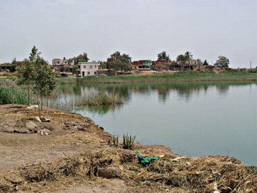
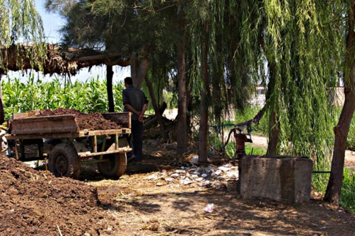
One of the villages at the site of ancient Naukratis.
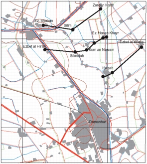
The Western Delta Survey project has also initiated a collaborative project with the Department of Geology in the University of Mansoura to carry out deep drilling transects and Vertical Electrical Soundings in the area south, east and to the north of Naukratis. The work builds on that of Professor Mahmoud el-Gamili and aims to traces the Canopic Branch and any distributaries from it in the Naukratis region. The main research question is to establish whether there is any trace of a natural or canalized channel linking Naukratis and Sais, that is, to establish an east-west communication route by water between the two places. The sites are only around 16 km apart as the crow flies, but one would have to cross possibly two main river channels and several canals in the non-inundation season. From a practical point of view, such difficult movement between the main port of trade at Naukratis in the Saite period and the Saite capital at Sais does not seem plausible. Both cities would have a direct link to Memphis, but it seems to be a reasonable hypothesis that there must have been a more direct connection by waterway.
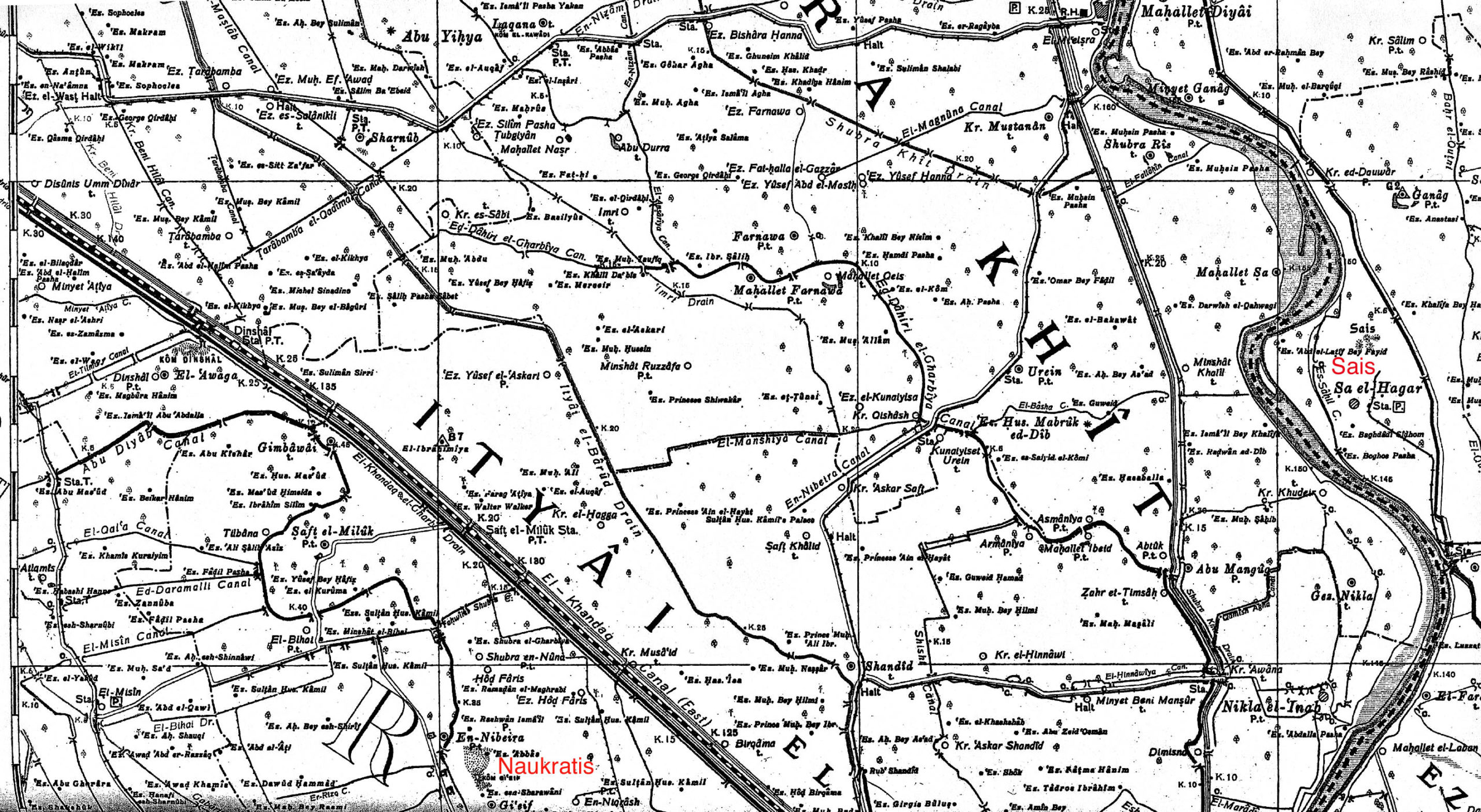
Survey of Egypt map from 1908 at a scale of 1: 100,000 showing the locations of Naukratis and Sais, and some older canals in the area.
Click image to view at full-size.
Using deep drill transects and the VES survey, Professors Hosni Ghazala and Adam Shehat will establish a detailed palaeotopography of the area and the positions of the older and more recent river channels, specifically the Canopic Branch, as well as investigate the possibility of identifying other more ephemeral distributaries.
Meanwhile, shallower drill transects are being undertaken in the area from Kom Hamada to the north-west of Damanhur to investigate the possibility of archaeological sites relative to the main Canopic Branch. The channel of the river has been identified using topographic maps and satellite images and the transects cut across the channel to identify the settlement patterns on either side of the river and the relationship of older and more recent villages to the river.
The combination of the detailed geomorphological data with the archaeological drill cores will provide a picture from which to establish both methodological parameters as well as to answer the specific research questions relating to the Naukratis-Sais link and the relationship between settlement patterns and waterways.
Drill Transects in Itay el Barud
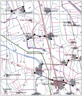
Transects north of Kom Hamada.
Click image to view at full-size (requires PDF Viewer browser plug-in).
(i) Transect from Biban-Kom Hamada-Barrim: five drill cores were made in this transect from west to east. The cores confirmed the presence in Biban and Barrim of thick deposits of stiff silt-clay, which may be formed from river bank deposits of silt and provide a firm base for the two towns. At Kom Hamada there seems to be evidence for a river channel underneath the area to the east of the main town in the form of coarse sand and fine sand deposits. This would fit the information from satellite images.
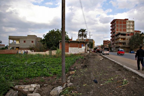
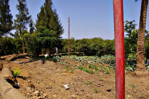
Main street through Kom Hamada. The drill team are working on the left of the photograph.
(ii) Transect from Biban-An-Naqidi-Kafr Damatyuh-Damatyuh, (5 cores). The satellite images suggest there is a bifurcation of the river at this point, possibly with one channel running north-east and a main channel to the north(west). The transect was inconclusive in relation to the main north-west channel, but seemed to suggest that there was a channel to the north-east. Both of the cores around An-Naqidi and Damatyuh contained cultural material in the form of pottery sherds, in the upper strata.
(iii) Al-Awamir-Saft el-Inab (5 cores). The area at Al Awamir showed deeper levels of pottery sherds (to 4 m) on a solid silt levee or river bank. The area between contained coarse sand at a relatively shallow level (1.3 m), which may be river or gezira sand, and at Saft el-Inab the fine sand found here may be deposited on the inside of a river bend.
(iv) Qaryat Ramsis to Qaryat Manniya (3 cores). The area at Qaryat Ramsis had settlement layers at a depth of 6 to 5 metres with intermittent pottery sherds at 4.6 to 4 m depth. This settlement debris was sealed down by alluvial mud, but suggests there is a buried ancient site at this location. It can not be linked to the name of the town, which was apparently derived from its name around fifty years ago, Ezbet Francis. The settlement here seems to be located next to a river channel which runs close to Manniya.
Drill Transects north of Naukratis

Map of the area north of Naukratis, with satellite data for the Canopic course added.
Click image to view at full-size.
(v): Shubra en Nunah area. In this area there was a small amount of pottery in the top 1m of agricultural land, which may be the spread out from the site of Naukratis or reflect outlying sites. According to the maps SN1 should have been upon a levee (river bank of mud or sand) and the silty matrix of the core reflected the regular sedimentation of such a feature. The later stages of the core had blue-black coloured silt which is the Holocene prehistoric level well known from the delta. The modern village of SN thus occupies a stable site which may date back for a thousand years. SN2 was located in the centre of what could have been the main river channel and the fine sand fill from 1m downwards seemed to confirm that this was an in-filled channel. SN3 was at some distance away and from about 1.5m downward seemed to contain silty-sands consistent with back-swamps which may have been left after flooding. The interface between the sand and silty swamp is around 1150 years ago possibly reflecting the time at which flooding ceased as the Canopic dried up. This could be estimated as follows: in the last hundred years there has been some erosion of the surface soils and flooding has been controlled, so the date can be calculated from around 1900 AD to the 8th century AD around 800-750BC. This is a very approximate estimation only.
(vi): Saft el Mulak area. SM1 was at the village of Saft el Mulak and SM2 at the nearby village of Talbanah – both should have been upon river levees. The core at Talbanah certainly confirmed this hypothesis with deep layers of stiff silty-clay. SM1, however, provided coarse sand at a depth of 4m suggesting the presence of a river channel. It seems to have been silted up around 1500 years ago, suggesting an earlier location for Canopic channel.
(vii): Jinbawy area. Jinbawy 1 seems to have been located in the river channel and the fine sand turning to coarse sand by the bottom of the core confirms this, with silting up complete around 1500-1300 years ago. Jinbawy 2 and 3 should have been on the river levee and the presence of stiff silty clay and pure silt seem to confirm this analysis. The presence of pottery at depths of 3m and 3m and 5m, however, also suggests the presence of an ancient site with periods of occupation at 2300 and 3800 years ago (that is, the Ptolemaic and New Kingdom periods?).
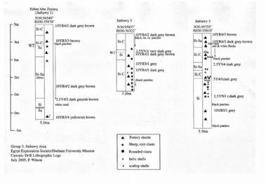
Drill core logs for the Jinbawy transect.
Click image to view at full-size (requires PDF Viewer browser plug-in).
The drill site at Jinbawy 1.
(viii): Dinshal area. The first core at Ezbet Sidi Yakoub could have been river or river bank and the core tends to suggest that this is river bank with consistent periods of annual flooding. There is a band of sharp root-clasts at 3 to 3.5m below ground 2300-2600 years ago (Ptolemaic to Late Period) suggesting very dry conditions, and then at about 4 to 4.5m (3000-3450 years ago – 1000-1450 BC) a period when this area may have been swampy. At Ezbet Esmain Shalke, the core was less clear but there could have a channel or swamp at 3m down. Further east, the core was similarly difficult to interpret with interlaced sand and silt deposits, but at 3-4m below the ground surface there was pottery, suggesting a site or settlement from the Ptolemaic period and earlier.
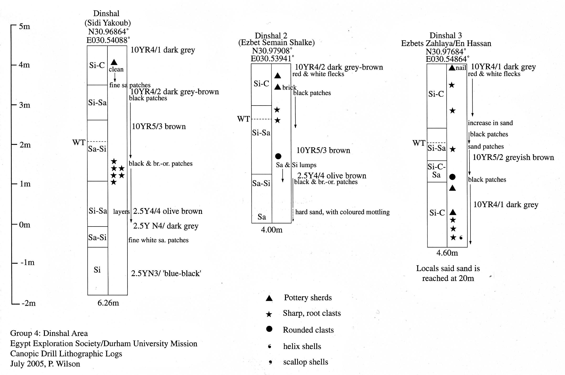
The Dinshal drill log.
Click image to view at full-size.
(ix): Minyat Attiyah could have been over a river channel and the results from the core suggest some kind of swampy or marsh environment at a depth of 2.25 to 3.25m (Ptolemaic period), then a channel cut into the sand before this.
(x): Disunis area. The town of Disunis (Damanhur) could be situated upon a river levee and the first core to the north-west of the town, to some extent confirmed this with a series of stiff silty deposits to some depth. At 4.5m, however, there was evidence of human settlement with pottery and burnt material just above blue-black humic silt. This could date to 3461 years ago, that is around early New Kingdom times, but in practice the presence of the material at the blue-black humic level is often more indicative of prehistoric settlement. Analysis of the pottery should give more conclusive results. The second Disunis core was drilled through an old birket in the town which was very clear in the upper levels of the core. Lower down the core there were bands of silty-sand material, with increasing sand or brown-orange mottling in places. These could represents bands of flooding, with times of relative aridity as shown by the root clasts in the soil matrix.
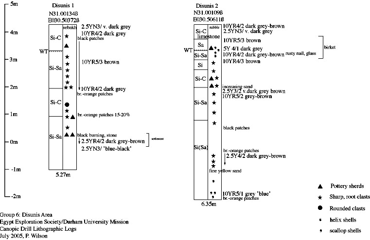
The Disunis drill logs.
Click image to view at full-size.
The Disunis drill site.
Conclusions
In general, the cores were successful in determining the presence of river channels, possibly the old Canopic river branch, and of other areas of back-swamp (marsh) or oxbow-lake. Though the rates of sedimentation are an estimation only, there seems to be a period of change in the Ptolemaic period and possibly in the New Kingdom. The Ptolemaic evidence may suggest environmental change or change brought about by human agency. The Canopic branch would have migrated over the course of its history, but the latest date from the drill cores for its silting up is in the eighth century AD, which can be checked against historical sources. The drill cores also, unexpectedly found evidence for early settlement in two areas – at Disunis and Jinbawy, suggesting that some established settlements in the Beheira area may have longer histories than is so far attested. Further drilling in the area could build up an interesting picture of sites which were abandoned and sites which have continued over the last 3000 years.
Drill Transects in Damanhur
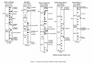
Map of drill locations north-west of Damanhur.
Click image to view at full-size (requires PDF Viewer browser plug-in).
(i) Iflaqah to Ezbet el Wasta (3 cores). The indications from this transect suggest that there is a river channel to the east at El Wasta.
(ii) Ezbet el Hirfah to Ezbet Hasan Khayr (6 cores). The channel identified above seems to continue at Hirafah implying that an ancient river channel runs from east to west to the north of the modern town of Damanhur. The channel seems, however, to be a comparatively ancient one because there was also an ancient settlement at Hirfah (now no longer apparent) in the Late Period and possibly before then. The river channel must have silted up and a settlement have been founded there perhaps from sometime in the New Kingdom onward. The archaeological site at Kom en Nawwam may be contemporary with the new Hirfah site but did not continue to flourish for such a long period of time.
The Hirfah drill logs.
Click image to view at full-size (requires PDF Viewer browser plug-in).
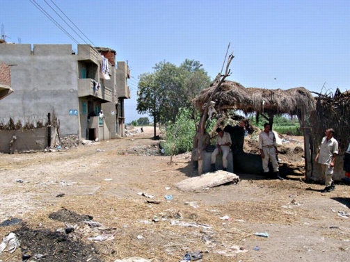
The drill site at Hirfah.
(iii) Ezbet Shaban to El Zarqun (3 cores). Ezbet Shaban seems to be an old settlement, though probably extends back into the historic period only. The settlement is founded upon a solid tafl clay layer. The transects shows that this area is part of the alluvial plain and no river channels are evident.
The information from these transects can be used to show the location of the Canopic Branch of the Nile in relation to the modern town of Damanhur, although a little more evidence is required from the area for further conclusions to be made.