Rashid
Rashid
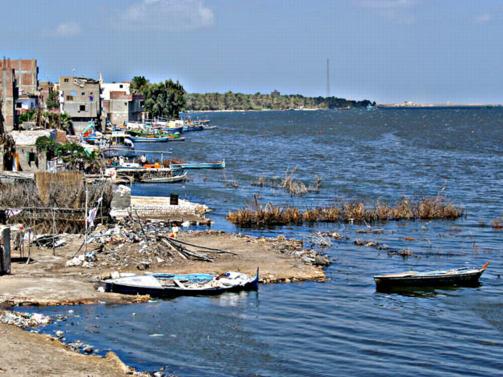
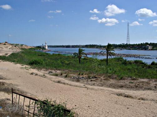
Riverfront at Rashid (Rosetta).
Rosetta is the main port on the western side of the Nile Delta after Alexandria. It was the main western point of entry into Egypt throughout the Middle Ages and modern times because the Rosetta Branch of the Nile led directly to Cairo. It was also an important centre for the distribution of exports from Egypt. The town was well defended and the famous Fort Julien (now Fort Qaitbey) was constructed using stone from sites in the Delta. A number of stone blocks, perhaps originally from Sais, can be seen embedded in the walls. For this reason the eminent Egyptologist Labib Habachi suggested that the Rosetta Stone found at the fort had originally been set up at Sais. The Rosetta Stone, with its text in Egyptian hieroglyphs, demotic and Greek, provided the main key in Champollion’s decipherment of hieroglyphs.
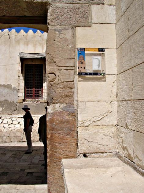
Doorway of the fort with embedded Dynasty 26 blocks.
The modern town has some beautifully restored eighteenth-century merchant houses, a Museum featuring displays showing the history of the town, including the town’s resistance against the British, the Fort and a corniche beside the river.
Tarbiyat el-Add (Map number 42)
This site is an old gun emplacement building for sea defences, probably dating to the late nineteenth century. The site consists of a building which has been partially covered by sand and is located on the sandy shore of the north-western coast on the road linking Rosetta and Alexandria. The sea comes up to the small beach to the north of the post. The building is square in shape, approximately 100 m by 100 m in size and oriented east-west, with an entrance on the western side which is defended by shooting-slots through the walls. It is constructed from red brick, packed with rubble made from local limestone. Inside the structure there are vaults for munitions and emplacements for three large guns which are still in position. The guns are made of iron and were moved into position by means of iron ‘rail’ tracks. They are similar to the guns used to defend Alexandria against the British bombardment of the city in 1882 and therefore must date from before this time. There was a small amount of pottery and modern rubbish inside the building, but mostly the debris contained glass fragments from wine and other types of bottles. There is a later coastguard station built at the site, but this is now disused. A modern Egyptian beach resort lies to the west of the building.
Although the site is not an ancient monument, it does have some historical interest and is part of a series of such sea defences along the Egyptian coast.
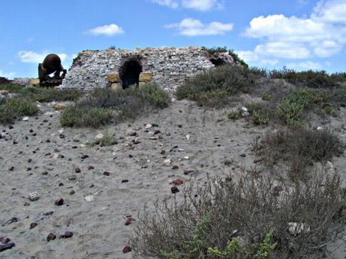
Gun emplacements at Add Fort.
Tarbiyat el-Alayem (Map number 43) is another sea-defence building similar to last and further to the west.
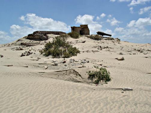
Mound at El-Alayem.
Abu Mandour (Tell Kom el-Farah on the Survey of Egypt map) (Map number 44)
The site is located to the south of the modern city of Rosetta and contains some of the old houses of the town and a cemetery. Egyptian excavations here recently have uncovered a large brick building, perhaps a house, and also some Pharaonic period sherds, suggesting that the history of this site is much older than the more recent structures suggest.
The site is a large, sand-covered rock outcrop beside the Rosetta branch of the Nile, reaching a height of 15-18 m and running alongside the river. The site extends for about 720 m north-south and 250 m east-west.
View down towards the river from Abu Mandour.
The sand covering the hill contains much pottery and there are structural remains on the western and eastern sides and a cemetery at the southern end of the hill. The highest part at the north of the site is occupied by a modern cemetery on it, a radio mast and old water tank.
The western side of the sand hill is covered by more pottery sherds than the eastern side and there is also a good sequence of buildings on the west, made from brown, burnt brick. The structures are well preserved to some height and may date to the 17th-18th century AD, although they also contain Late Antique period pottery.
Structural remains at Abu Mandour, buildings probably dating to the 17th-18th century AD.
During our visit here we also found a magical ring bezel intaglio in lapis lazuli showing the multi-winged form of Bes. This perhaps dates to around the 2-4th century AD. It was near this location that the Egyptian excavations located Pharaonic remains. The occupation levels at the site may provide a good stratigraphic sequence.
On the eastern side of the sand hill there is a red-brick, vaulted structure, perhaps earlier in date than the western building and buried more deeply in the sand. This was associated with Late Antique pottery.
The majority of the pottery studied at the site dated from the 4th to 7th century AD, but there was some earlier Late Period material as well as Islamic green glazed sherds.
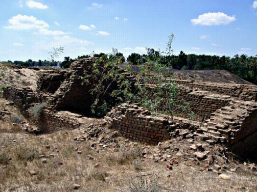
Tell Dibi (SCA 100177) (Map number 51)
This site seems to have been famous as the location of an Islamic Gamaa, but it is difficult to discern the older layout of the area. There is a modern town here and a 8-9 m-high cemetery mound, which must be what was once part of the older site. The cemetery site has the tombs of two sheikhs, Sheikh Fatallah and Abu Shushu. There is a new school built on the western side of the area.