Introduction
Introduction
The Regional Survey is part of the ‘Sais and its Hinterland’ Project funded by the Arts and Humanities Research Council and administered with logistical support by Durham University and the Egypt Exploration Society. It is carried out with the permission of and in collaboration with the Supreme Council of Antiquities in Egypt.
Special thanks are due to Professor Zahi Hawass, the Chairman of the SCA, Dr Magdy Ghandour, the head of the Foreign Missions section, Dr Mohammed Abdel Makhsoud, Head of Lower Egypt, Fawzy Fawzy el Kholy in Damanhur, Abd el Ghany el Zaki and Said Mutawalli in Tanta and Abdel Fattah el Eid in Kafr esh Sheikh and his predecessor, Ibrahim el Saidi.
Damanhur, with the Rosetta branch of the Nile in the distance.The Western Delta Survey grew out of the ‘Sais and Its Hinterland: Dynamics and Power in the Western Nile Delta’ project. Sais (Sa el-Hagar) is situated on the east bank of the Rosetta Branch of the Nile about half-way between Alexandria and Cairo. It lies in Gharbiyah Province with the Province of Kafr esh-Sheikh to the north. On the other side of the river is the large western province of Beheira, which extends from Alexandria in the north to beyond Kom Abu Billo in the south. Both Beheira and Kafr esh-Sheikh contain many archaeological sites which are not well known to Egyptologists, Classical Archaeologists or tourists.
The largest site in Kafr esh-Sheikh is the major centre of Buto (Tell Farain) but there are numerous other tells and koms (small mounds) which represent the ruins of ancient towns and cities. Many of them date to the Roman period and later, but some of them also have much longer histories. In Beheira Province, Alexandria dominates the north-western area, but again, there are numerous sites to the south, such as the Ramesside fort at Tell Abqain, the Greek city of Naukratis and Kom Geif and the multi-period site at Kom Firin. Increasing attention to the Delta in general has led to new work at Tell Ghuraf by the University of Rome.
The Egypt Exploration Society has a long history of working in the Delta and its earliest missions by Naville and Petrie were at Tell Nebesheh and Naukratis in 1887 and 1888. In the 1990s, Jeffrey Spencer initiated the Delta Survey, the aim of which was to collect information on the current status of sites in order to assess those sites which might form the basis of larger projects. Jeffrey and Patricia Spencer visited many sites in the Eastern and Northern Delta close to the site at Tell el-Balamun, where there is a British Museum Mission. In addition, Steven Snape visited other Delta sites, building upon his earlier work with Joyce Tyldesley in Sharqia Province in the Eastern Delta (S.R.Snape, Six Archaeological Sites in Sharqiyeh Province, Liverpool 1986.). He identified Sais (Sa el-Hagar) as a possible future project and survey and excavation work was begun here by Penny Wilson in 1997. Sais also proved to be a good base for further survey work, allowing the team to visit places to the north and west to collect information about other sites.
In the Western Delta, survey work has also been carried out by Neal Spencer based at Kom Firin, Susanna Thomas based at Tell Abqain, by the American Mission of W.E. Coulson and A. Leonard at Naukratis and by Edwin van den Brink and Pascale Ballet working in the area around Tell Farain. There are other missions in the North-east Delta and Sinai which routinely carry out larger scale surveys based on a central project. Joanne Rowland has also begun work based at Quesna in the Central Delta and using this project as a base from which to visit nearby sites in Menoufiyah Province, again with the support of the EES, the British Academy and the Wainwright Fund.
In Sharqia province, extensive survey and mapping work was carried out by Edwin van den Brink in the 1970s for the University of Amsterdam in the Eastern Delta, as well as in the environs of Tell ed-Daba/Qantir by the Austrian mission led by Manfred Bietak. This work has formed the basis of an exciting project funded by the Finnish Government and supported by the Supreme Council of Antiquities in Egypt called the Egyptian Antiquities Information Service. The aim of the project is to provide accurate and up-to-date site assessments and information about archaeological sites over which the SCA has legal ownership or rights. The aim was to improve site management and heritage development projects. As a result all detailed surveys, mapping and information are sent to the EAIS to add to its database and to ensure that details of the sites are current. The material contains a detailed risk assessment of environmental and other pressures on the sites and will be a valuable aid in the cultural management of such places. Atlases listing all of the SCA sites are being published for the whole of Egypt. A more detailed volume on the sites in Sharqia province has also been produced, with extensive satellite and cadastral mapping as well as full risk assessments for the sites. It forms the basis of an unparalleled project to identify and preserve archaeological information from sites throughout Egypt.
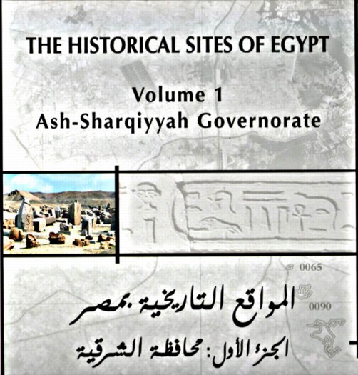
Front cover of the Sharqiya EAIS Atlas.
Aims of the Western Delta Survey
The survey has two mains aims. The first is to provide a regional context for the major site at Sa el-Hagar, that is, to examine its relationship with other places in the Western Delta, how it was connected to them physically and culturally and to begin to understand how Sais and other places developed over time in relation to one another. For example, was Sais in the 7th-6th century BC a kind of prototype for the city of Alexandria from the 4th century BC? With the rise of Alexandria, moreover, what happened to the power and status of Sais?
The second aim is to look at individual places and their relationship to their ancient environment. In particular, we wanted to assess whether sites were primarily situated on levees or sand hills beside branches of the River Nile and what happened to those sites when the river branch silted up. It is likely that the Canopic Branch of the River Nile in the Western Delta supported and provided a communication network for many towns and villages, but that when the branch dried up, those settlements could no longer sustain the same kind of existence. By surveying the sites along and adjacent to its former course, it was suggested that some indication of the date of the sites and their abandonment could be obtained from a study of pottery and archaeological material found there. With additional data from drill core transects, it was hoped that evidence could be gathered about the environment and earlier development of the sites.
In order to make the conclusions more pertinent, Sais is used as a control site because its development is understood from the Neolithic period to the modern day and its palaeoenvironment and relationship to the Rosetta Branch of the Nile is known. In addition, sites in Kafr esh-Sheikh which also depended upon defunct Nile distributaries were also surveyed to establish whether there were special factors pertaining to Beheira sites.
Methodology
The survey has been carried out to different degrees in different places.
Some sites were visited and, because there was nothing clearly visible there, little information was gathered.
Some sites were visited, their size measured and pottery was collected from the surface or from ditches to provide information on the dating of human activity there.
Some sites were visited, a topographical survey (map) was made of the area and pottery was collected from the ground surface and ditches. In some cases, drill cores were also made in transects across the area.
Some towns without registered archaeological land had drill cores made in transects in order to locate and define the Canopic Branch of the Nile. Drill cores were also made to discover any buried archaeological material suggestive of the presence of a town and to determine the location of such settlements, that is, whether upon a silt levee or sand hill.
The work aimed to obtain basic information in a limited amount of time which could be mapped and integrated with other data from published and unpublished sources to create a picture of settlement patterns, the dynamics of riverine settlement and the relationships between groups of towns over a large area.
The work is preliminary in nature in order to begin to build models for the development of settlements in the Western Delta. As a by-product it has also identified places with potential for future work.
Preliminary Results
1. Most of the sites visited and surveyed date to the later phases of antiquity. Only a few had traces of Pharaonic pottery or other material. This may be due to the fact that the Pharaonic layers are deeply buried under the main sites, so surface finds, and even ditch pottery would not provide evidence for earlier occupation. On the other hand, drill cores in some of the sites have not always located deeply-buried human cultural material. The main phases for the north-western and northern sites seem to be from the Ptolemaic Period, through the Roman period, to the Late Antique period. It is noticeable that the Kafr esh-Sheikh (northern) sites tend to show evidence for later occupation into the medieval period. The later occupation may be due to the fact that the Kafr esh-Sheikh sites are simply better preserved and the Beheira sites have been eroded from the top down. It may reflect the fact that the distributaries in the north of Egypt lasted for a much longer time than those in the north-west and sustained their towns to a later date. The abandonment of all of the sites may also be due to the depopulation of Egypt in antiquity or that fact that settlements shrank and were refounded nearby, forming the basis for modern towns and villages in both Beheira and Kafr esh-Sheikh. In this case, further drilling work at established towns may provide information about their life-span.
2. Not all sites listed as archaeological sites have identifiable archaeology at the site at the present.
3. Some towns which are not listed as archaeological sites have deeply-buried human cultural material, but it is only accessible by drilling.
4. The presence of a river channel to the existence of settlements does seem to be important. Some sites lie along north-south lines, most likely sited beside a river distributary. Other archaeological sites which are relatively undisturbed show a north-south linear arrangement as if they extended along a river bank.
5. The presence of a 15 km zone around Sais devoid of other notable archaeological sites may suggest that the clusters to the north are the result of expansion of the settlement network from the Ptolemaic period onward on a different pattern to the ancient Pharaonic pattern. The latter depended upon central large towns with major cult centres (temples) and small hamlets, which have not survived, around them. The Ptolemaic and Roman pattern meant that reclaimed and drained agricultural land at this time was settled in a regular pattern by the foundation of farming towns and communities, moving outward along the river channels. This kind of growth ended around the 6-7th century AD in Beheira and in the 10th century in Kafr esh-Sheikh. Major development, land reclamation and resettlement probably did not begin to occur again until the irrigation schemes of the late nineteenth century.
6. The various types of pottery identified from the survey has shown the wide area from which products were imported, ranging from Northern Africa (Tripolitania) and Italy, especially in the Roman period, to the traditional markets of Greece, the Aegean, Cyprus and the Syro-Palestinian coast. In addition, local types of distinctive pottery, perhaps made from Delta clays and in local kilns, have added to the known repertoire of locally produced products.
The results of this survey will be published as a monograph as The Regional Survey of the Western Delta (N. Beheira and Kafr esh Sheikh Provinces).