Burullus
Delta Survey in the Lake Burullus Area, 2012
The aim of this phase of the EES Delta Survey was to visit sites for which there was no information in the Survey database, to record any standing remains, to inspect and record pottery from the surface where possible, as well as provide contour maps for the largest sites. Since the early survey work, satellite imagery now makes the identification of sites, some of their features, shape and size as well as any outlying areas much more certain. It is still necessary, however, to ground truth the satellite images in order to be certain of what they actually show. For example, elevation can be inferred from the images, but the way in which the site has been formed and its detailed features are not easy to define from the images alone. In addition, pottery, glass and other finds as well as standing buildings or building traces still need to be checked in order to provide dating and archaeological evidence for the sites.
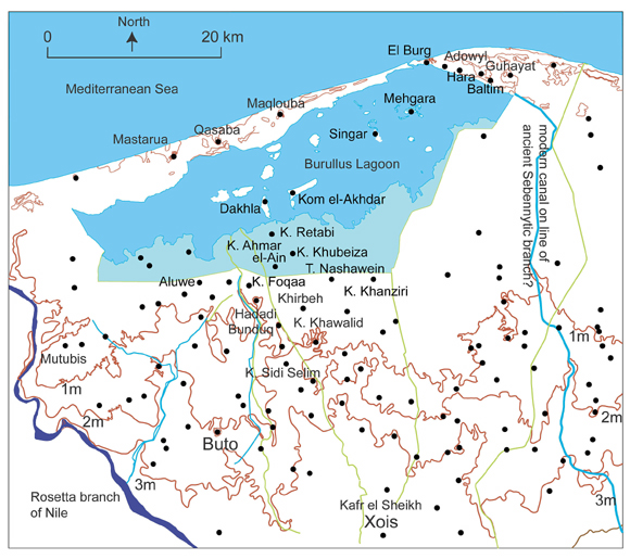
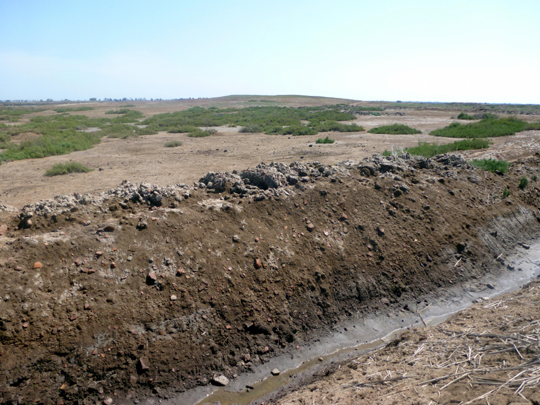
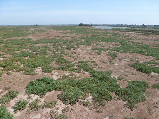
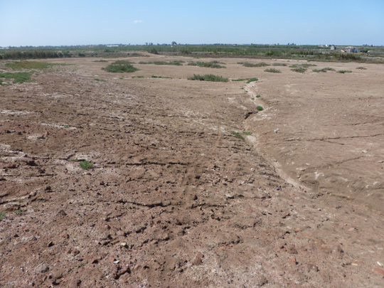
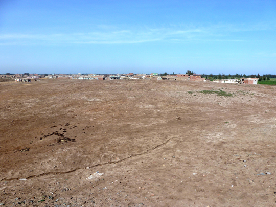
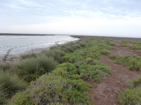
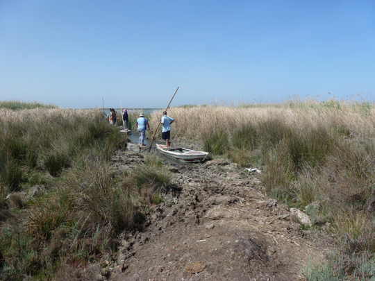
Groups of sites were identified for further work in and around Lake Burullus. They were often quite remote and distant from the large centres of population and, in some cases, are difficult of access due to the fact that they lie in the southern edge of the lake-marsh area which has been converted into fish farms in modern times. The fish farms are created by the dredging of large squares or rectangles of water, with the resulting mud being piled up to create embankments and they, in turn, create a network of trackways through the fish farm area. Other groups of sites lie on the northernmost coastal edge of the Nile Delta or inside the lake on a series of islands and so are accessible by boat only.

1 Sites Lying south of Lake Burullus
A number of the larger sites had already been mapped by the EES Delta Survey and other missions, such as Kom el Khanziri, Kom el Khawalid (also investigated by a mission from Uppsala University), Foqaa but there still remain a number of places without further information in the area of fish farms and the fringes of the fish-farms between Sidi Selim and the edges of Lake Burullus.
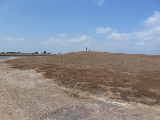
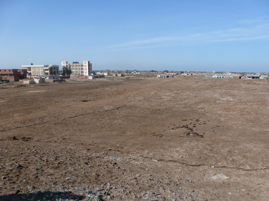
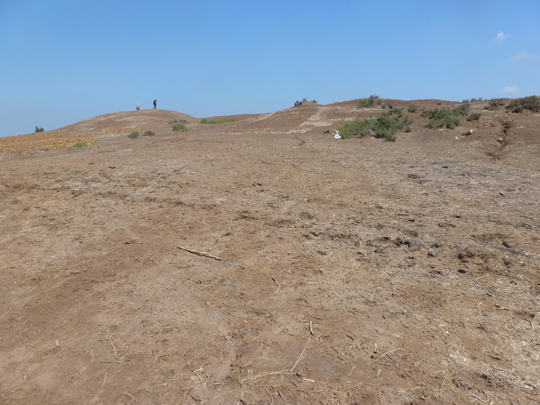
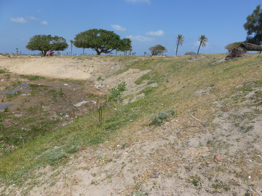
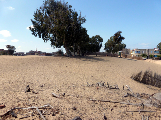
1.1 Nashawein (SCA090144; 31 21 17N, 30 52 35E)
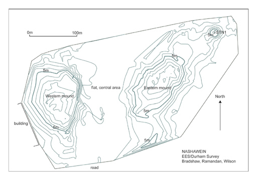
Click image to view at full-size. (Requires PDF Viewer browser plug-in.)
The name of the site with its Arabic dual form suggests that this is a double site and the topography confirms this impression. The tell at Nashawein is large, covering a maximum of around 1000 m in length by around 550 m in width and with a maximum height on the eastern mound of up to 10 m.
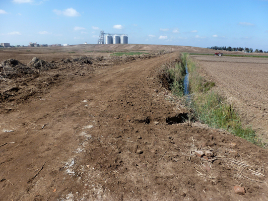
The site has two main mounds to the east and the west with an approximately 100m band running from north to south through the middle of the site. It may be that the site was always in two parts hence the double name. The nature of the land running through the site is not clear, but the area seems to consist of hard, compact silt with some few fragments of pottery lying on the surface. It may be the remnant of a waterway, which ran through the area and was ‘decommissioned’ when the new irrigation system was completed or may have run dry of its own accord sometime in antiquity.
The western mound in particular shows building plan traces on the surface either as pale bands running along the ground or in the growth of small plants where water has collected usually in the inner part of a room of a building. These inner rooms are usually depressions so rain water can collect there and so the vegetation grows rapidly. The difference between the higher, more solid ‘walls’ of the buildings and the softer, vegetation filled room depressions can be easily seen and felt underfoot. There seemed to be a large rectangular building on the southern part of this mound running from north to south and it may also be visible on the satellite image.
The eastern mounds consist of a smaller outlying mound separated from the main eastern mound by a depression between them and building plans were also visible on the south-western slopes of this mound. The edges to the south-east were being used for animal grazing and a new water filled trench had been dug in this part of the site. At the very south, a small area was being used as a cemetery and this too may have once been part of the original eastern part of the site. The southern sides of these eastern mounds were gently sloping with water-cut gullies running through the sides.
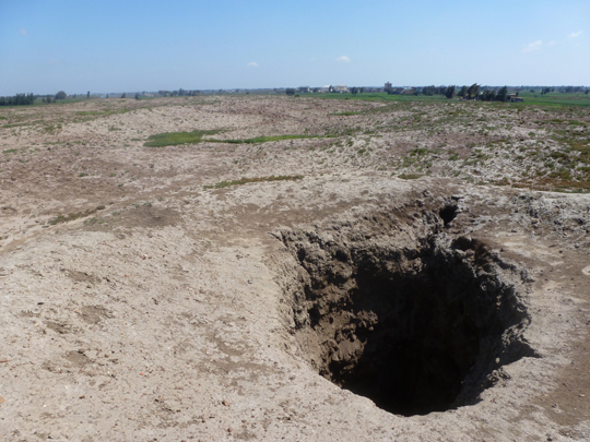
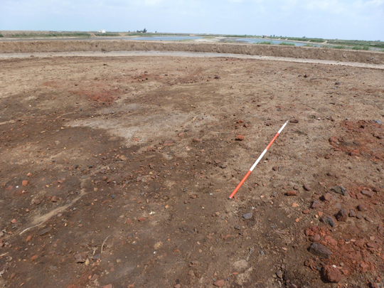
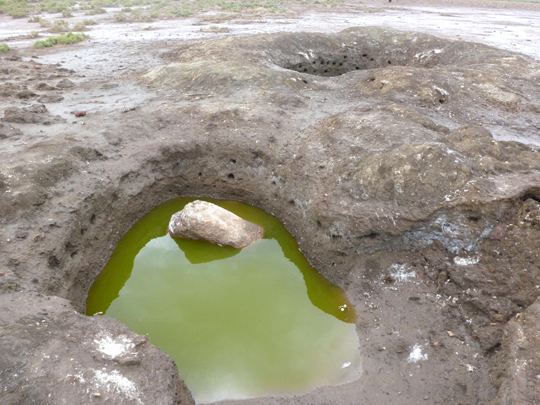
A deep hole had been dug on the top of the eastern mound to a depth of around 4 m. This provided the opportunity to look at the section through the mound. There was archaeological stratigraphy for the whole depth of the pit, including fired brick and possibly some mud brick at the lower levels. The pottery from the pit did not seem to be noticeably different in date from that lying on the surface of the site.
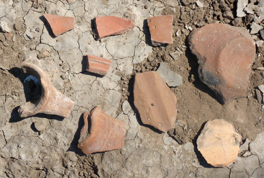
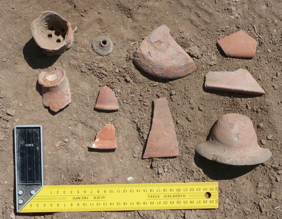
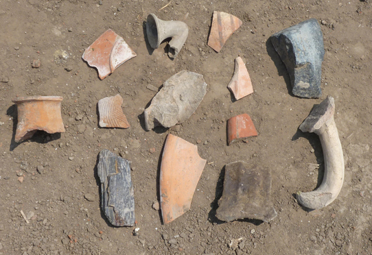
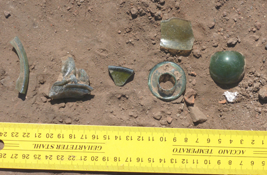
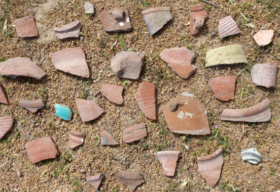
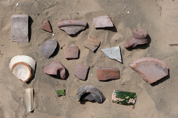
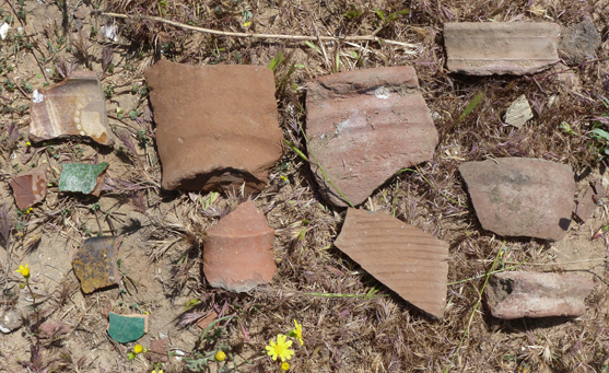
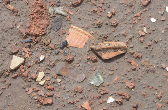
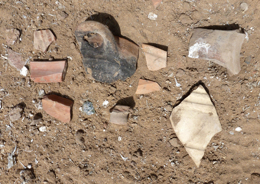
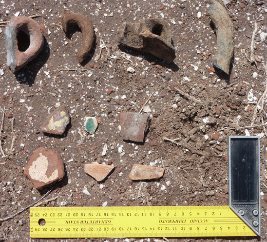
The surface cover of the mounds consisted of pottery and fired brick fragments, including in places some vitrified brick fragments. There were also pieces of glass in many places. It was difficult without a detailed survey to detect whether any one area in particular represented more glass working or specific types of pottery.
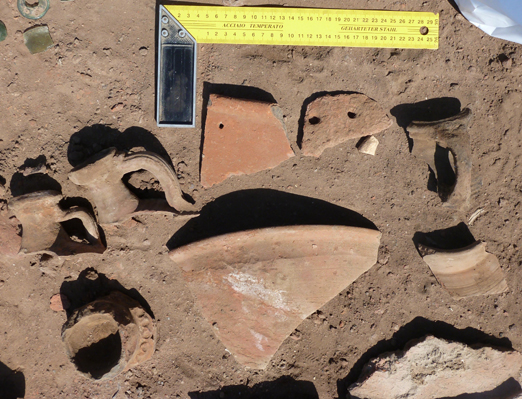
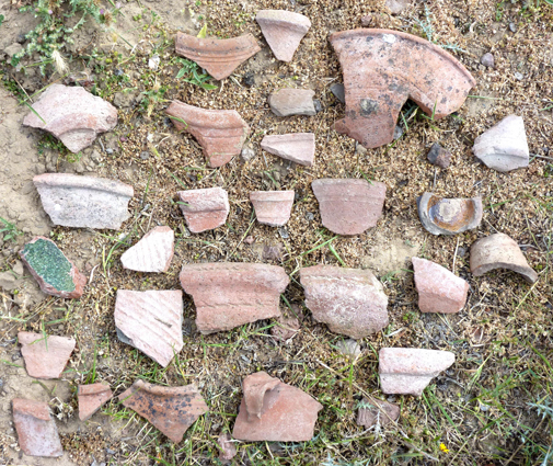
The pottery mostly dated to the Late Roman period and included examples of the LR1 type of amphorae, cooking vessels with ledged rims, pie crust dishes and some with painted decoration on the inside, as well as ledged ‘bitronconique’ AE3 amphora spikes. All within the Late Roman period and perhaps Early Arab period for the painted pie crust dishes (4th to 9th century AD).
The central channel, the size and Late Antique to Islamic date of the site make this a particularly interesting place worthy of further study.
1.2 Tell el Khebeiza (SCA090120; 31 23 14N, 30 49 54E).
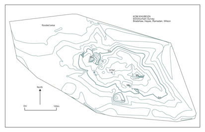
Click image to view at full-size. (Requires PDF Viewer browser plug-in.)
The site consisted of one main long mound, covered at the time of the visit in vegetation, with an outlying, more circular mound to the west. The mound was around 660 m in length from east to west and about 285 m at its maximum extent from north to south. The northern side of the mound was gently sloping and had rainwater run-off gullies, some of which were quite deep and had exposed pottery and brickwork from the mound. The southern side of the mound was more gently sloping and the height of the whole mound was a maximum of 8.5 m above the lowest point, although it was surrounded by an embankment with a track, separating it from the fish farms. The main mound was red in colour and the surface was covered in degraded pottery and red brick, some of which had been vitrified, as well as glass and some fragments of corroded bronze material. The surface varied from being hard underfoot to soft in places, perhaps representing walls and internal features of buried structures.
The western side of the mound seemed to have been cut away by the fish farms and so the present condition may not represent the original extent of the mound. Large amounts of red brick, including square examples 21 by 21 cm in size, and larger pieces of pottery from cooking vessels and amphorae of various kinds lay at the bottom of the embankment on this side. The amphorae including LR1 types and there was also a limestone mortar some 47 cm high embedded in the dyke.
The north-western mound had slopes which were soft underfoot and solid in the centre, perhaps representing the remains of one building. There were dog holes dug into the north-western side of the mound where the soil was softer, brownish and looser. There may also have been some human activity at the site, but it was on a very small scale.
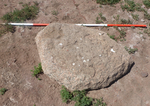
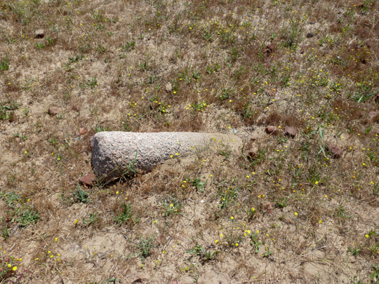
The pottery from the site showed a good range of Late Roman material including painted wares, Cypriot Red Slip Ware and perhaps some Egyptian Red Slip Wares, as well as amphorae with a bright orange fabric and white-cream wash over the surface. Corroded bronze coins and glass fragments also lay on the surface, the latter in large numbers in places. There were three fragments of red granite lying on the surface of the mound, including half of a red grindstone 128 by 78 cm and 32 cm thick, a buried grindstone and another red granite fragment 113 cm in diameter by 51 cm and 24 cm in thickness.
The material on the site seemed to be consistent with the other Late Roman sites in the area, so possibly from the 4th-9th century according to the pottery.
On the western side of the site there seemed to be an area of kilns. Two of the kilns inside a brick surround were clearly visible and the ground surface was covered in slag.
A fragment of a large limestone mortar was found north of the site in the tracks of the fish farms. There may once have been more extensive outlying areas of the site
1.3 El Kom el Ahmar El Ain (SCA090109; 31 22 48N, 30 48 30E)
(See also P. Wilson and D. Grigoropoulos, West Delta Survey, 2009, p.259-69).
Kom el- Ahmar is a low mound, perhaps as much as 10 metres above the level of the surrounding fish- farms. It is approximately 250 metres from north to south and 360 metres from east to west and so is quite substantial in size. The surface is dusty and powdery, but does have some pottery sherds and red bricks lying on the surface, which has a noticeably red colour. The northern slope of the mound seems to be steeper, with water gullies cut into it, whereas the southern slope is gentler and tails back, perhaps as a result of wind erosion.
There were two red granite grindstones lying upon the top of the mound, with square holes through the centre, both of which had smoothed surfaces and seemed to have been well worked. There were a number of other fragments of red granite on the northern and southern sides of the mound. They looked quite worn and eroded, although one had a flat, smoothed side. There was also a block of limestone on the mound. No pottery was collected.
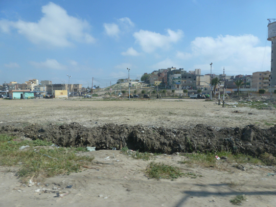
1.4 Tell el Retabi (SCA090123; 31 24 25N, 30 48 22E
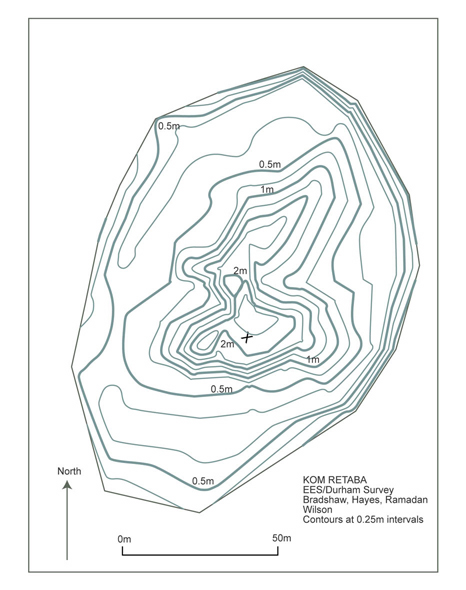
The surviving tell is approximately 154 m in its maximum length, 100 m from east to west and it stands no more than 2.4m above the level of the surrounding area.
There are a series of embankments and ditches for the fish farms around the tell. It is not possible to determine whether the surviving mound is the remnant of a once larger site. The embankments surrounding the site have red bricks and pottery in abundance lying along their sides and this material has been washed out of the embankments by the water from the fish farms some of which had been drained at the time of the survey team visit. It is likely that the embankments had been created by heaping up earth from the lower levels of the mounds and so it is unclear whether the material represents a cut away part of the site or is just debris collected from the site to make the embankments. In any case the embankment and fish farm material was, on the whole, in better condition than that on the surface of the site itself. The latter was extremely eroded and degraded by salt action. Some large amphora, plate and bowl fragments came from the embankments as well as a complete pipe bowl and a fragment of basalt or black granite-like rock with one smoothed edge.
The tell itself was red in colour especially in areas on the top of the mound. As far as could be judged the more solid red surface of the tell was horseshoe shaped, with the open end to the east. The eastern side consisted of a depression filled with loose, powdery brown earth. It may have been dug out and the solid features of the crescent shape left behind. On the western side of the mound there was also an area of looser powdery soil, in which several dog holes had recently been dug suggesting that this was softer and easier to dig into. In places on the northern side of the mound, which was more eroded and had less loose material on the surface, several red brick walls could be seen in various configurations. One feature to the north looked like a small chamber with traces of burning inside it and there were fragments of burnt pottery material lying around it. On the north-eastern side there was another set of red brick walls which may have been part of a more substantial construction.
The south side of the mound was more gently sloping and differential colour patterns could be seen on it, although there seemed no discernible structural elements. There was no plant cover on this tell, which was a little surprising in view of the fact that the satellite image from 2009 imagery shows green plants on the tell and other tells in the area did have a good cover for this year 2012. The prevailing wind on this visit blew across the tell and was especially cold on this occasion, but it is not clear whether this was the reason for the lack of vegetation.
The material on the tell seemed to consist of a good deal of finewares, including perhaps ARSW and CRSW, cooking vessels, LR1 amphorae and imported amphorae. There were some few glazed wares suggesting that the site went on into the 10th century and the pipe bowl picked up from the embankment material might also hint at a medieval or Ottoman presence at the site as well as a number of filter jug necks. There were also a number of corroded small bronze coins and other bronze objects including a fish-hook and what seemed to be a model pickaxe head.
1.5 Khirbeh (SCA 090169, 31 19 42.5N, 30 50 56.7E)
The mound was west of an area of muddy ground with small houses and animal pens all over it. There was a small cemetery to the south-west of this spread out village. The mound itself had a medium cover of debris including red brick and some pottery and the surface was a mixture of loose and then denser, harder brown mud. The mound was approximately 90 m from east to west and approximately 70 m from north to south, although the northern edge was rather indistinct. A track went around the northern and western side of the site and seemed to be founded upon solid, compact mud. The top of the mound was quite flat with the northern slope gently sloping down and the southern side steeper.
Some building plan were visible on the eastern side of the mound. The whole surface was also covered in places, especially on the south-eastern side with piles of broken modern glass and discarded medical material. The pottery on the mound was Roman in date and included some recognisable fragments of AE3 type amphorae and it was mixed with some Roman period glass. It seemed to date more the Middle to Late Roman in contrast to the other sites in area which perhaps continue to a later date.
There was a grindstone in the backyard of a house at the track entrance to the site. Its dimensions were 135 by 118 cm and it was 27 cm in thickness. It had a rectangular depression in the centre and was rather irregular in shape.
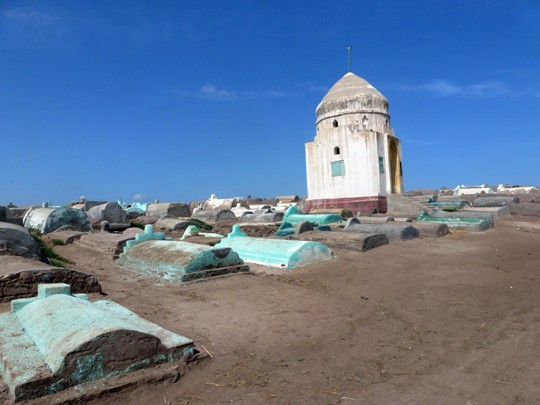
1.6 Hadadi (SCA number: 31 19 55.7N, 30 47 17.8E)
This site is a cemetery covered mound lying to the north of the village/town of Hadadi. The mound is oval shaped, lengthways from north to south. The northern side seems to have been cut way some time ago and the field boundary patterns follow the contour of the tell, suggesting that the tell may once have extended out further to the west. To the south of the village there is a depression, about 1 metre below the village level, now used for agriculture. It is not clear whether this is a natural feature or a man-made hollow which has been turned over to agriculture, but it seems to have been avoided for use for houses. It may then have some connection with the ancient site as a water pool or harbour? To the eastern side there is a large area of fields which may also have once belonged to the site making it more rectangular in shape and around twice the size. This suggests that the tell may have been cut on half with the cemetery effectively preserving the site underneath it. The soil from the site may have been required for the land reclamation and other earth using projects in the area. The tell is approximately 250 metres in length by 150 metres in width and up to 3 m in height.
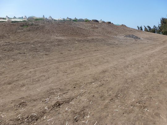
The western edge of the tell is about 4 metres above the field level and in places there are clear red-brick features and pottery. Some of the modern graves have been partly dug into the tell and pottery fragments and other debris has been thrown out onto the tell. From this material the site dates from the Late Roman period according to the material on the top of the tell. Some pits dug into the tell also showed stratigraphy with red brick debris to a depth level with the track around the base of the pit. In one place a red brick wall belonging to a building had been uncovered. The southern edge of the tell had also been cut cleanly away and also showed stratigraphic deposits, including brick rubble, burnt strata and pottery fragments, as a well as mud-brick debris.
The cemetery on top of the tell was quite densely packed but it was still in use and seems to have begun at the south-eastern side of the tell and gradually spread west and north and south west, with the western side having less dense grave cover. A tomb of Sheikh Mousad lay at the south-eastern corner of the mound and seemed to be the best kept tomb on the site. The eastern side of the mound was flat and consisted of hard compact mud. Where the sides were clear, there was red brick and other debris visible in the sections. Some of the material may have been from graves constructed out of red brick.
The pottery associated with the mound was Late Roman, to medieval Islamic in date, mixed with modern material.
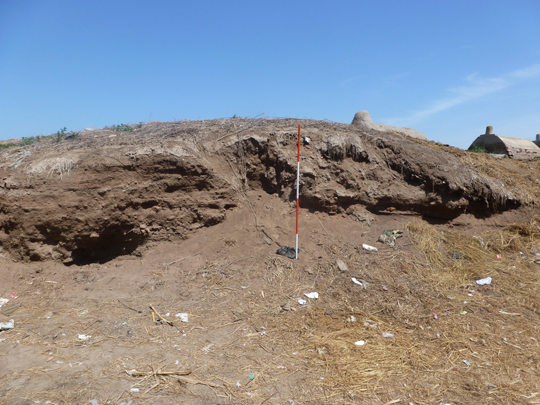
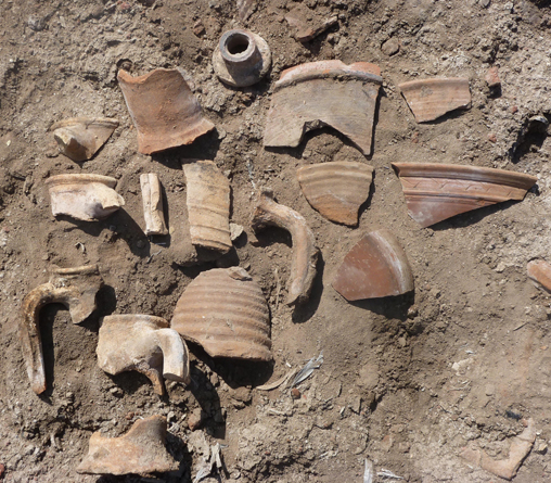
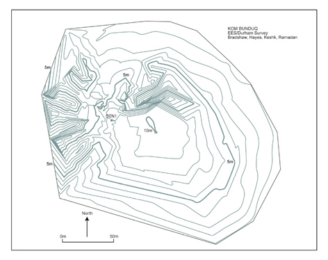
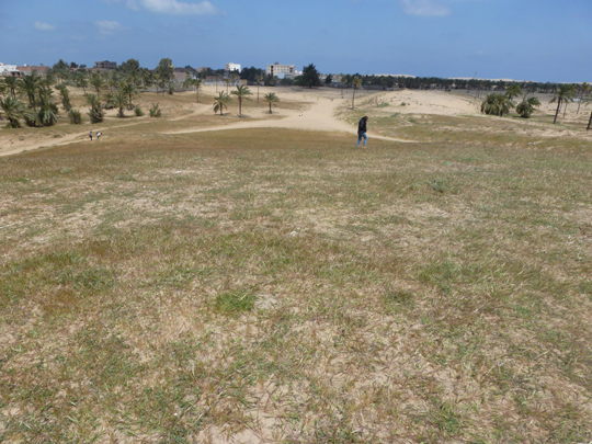
1.7 Kom el Bunduq (SCA 090113: 31 19 45N, 30 47 00E)
Click image to view at full-size. (Requires PDF Viewer browser plug-in.)
The site lies four kilometres south-east of Hadadi and may be related to its function in some way (with Kom el Misk and Kom Sidi Selim all further downstream on a potential ancient waterway). The shape of the at present is a crescent shape with a portion removed from the southernmost side. The high sides and northern side are flat on the top of the mound, with shallow sides continuing from the north side of the mound. The maximum dimensions of the mound are 263 m by 217 m and it has a maximum height of around 10 m above the field level.
The mound stands on something of a platform as the sides have been cut back leaving the lower level of the mound at least one metre above the field level and then the mound stands on top of that platform. There are building plans visible one each side of the mound, defined by pale stripes amongst the pottery, brick and plant cover. The large bay on the south side of the mound may have been caused by sebakhin digging as it has gone down to basal mud on the northern side of the depression. The sides of the bay are completely covered in pottery, suggesting that some of the soil may have been sieved out and dumped back on the mound. As for the other mounds in this area, the surface material was very eroded and fragile and subject to salt damage. The tell surface was also very dusty and significant amounts of dust were blown from the top of the mound during our visit.
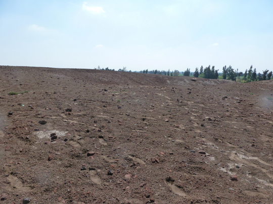
The surrounding edges of the site were flat and more dusty in nature. A number of small holes had been dug at specific places on the mound and there were also a number of dog holes in the softer, mud areas.
A good amount of pottery was gathered from the site, much of it from recently dug pits and also from the sebakh-seived material. It mostly dated to the Late Roman and Islamic periods.
2. Sites at Baltim.
Baltim is the main city on the lake side of the Burullus lagoon and potentially the site of the capital of the lake in ancient times, known as Parallos, from where the modern name of lake comes. The medieval name Al-Burullus ar-Raml ‘Burullus the Sandy’ seems to agree well with the sandy topography of the area even in modern times. The modern coastal road, a dual carriageway, separates the shoreline with its boat harbours and workshops from a line of houses, some of which are set back across a canal or waste land. Behind these houses there are lines of sand hills and some of the hills seem to preserve remnants of archaeological remains. If they are part of Parallos, then the pottery on some of the hills said to be the tell sites seems to agree with a medieval or more modern date.
From east to west the survey team visited :
Ghruhaiyat (Ghawett), Hara (coordinates given in the Atlas put this place underwater), Dawafyr (possibly equated with Awlad Dawfir on the 1:50,000 map) and Adowyl (also underwater according to the Atlas).
At Baltim itself a promontory, perhaps a naturally occurring sand hill or limestone ridge, was noted which had an administrative building upon it. This would certainly have been a useful and strategic site, so one might have expected that this would have been an important part of the controlling stations on this internal part of the lake. It would seem, however, that the area has been heavily overbuilt so that little remains of any archaeological material. The sand hill sites were reminiscent of Abu Mandour at Rosetta, which was a similar type of topographic feature, with pottery and some brickwork mixed in with the sand. The mud and fired brick buildings seem to have decayed leaving behind some shells on the surface which was a brownish colour as opposed to the brighter yellow of the sand.
2.1 Ghuhaiyat (31 33 37N, 31 04 32E)
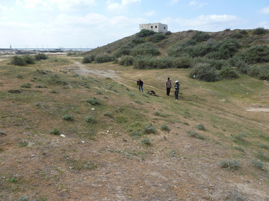
The site consisted of a low sandy ridge with some pottery cover, to the south of which was a higher (8m) rectangular ridge which had the ruins of four defence buildings with concrete ‘runways’ at the ends of the ridge leading up to the end square buildings. It was not clear whether this was a natural feature or a man-made hill for the purpose of the defence structures. They were estimated to be fifty years old, but there was not really anything to confirm this dating (local knowledge seemed lacking or there was an unwillingness to say). North of the two sand hills there was a quite large expanse of sandy hillocks and on the satellite imagery from 2010 (check) the area was clear of buildings. When we visited several new houses had been erected and construction of several other house was underway.
2.2 Hara (31 33 57.8N, 31 03 54.3E)
The site was a high (8-10 m) sandy mound with a group of old Sycomore fig trees planted in two lines on top of it and south of the trees in a horseshoe shape cut away from the mound there were traces of decayed mud brick which had turned the sand a brown colour. The distinction between the bricky-sand and the sand was quite clear, showing the edge of a building. In addition, shells lay on the surface which may have come from the decayed mudbrick and they had been mixed in with the mud for the bricks.
The surface of the site, especially under some of the trees was covered in grass mixed with small pottery fragments. There were many glazed pottery sherds and some modern material on the site, but in the mud-brick area there seemed to be a preponderance of large dishes, coarsewares and glazed fragments, There were also pieces of marl water jugs and some decorated fragments from such jars. The area was quite extensive (dimensions) and the fact that the trees looked at least 50 years old if not more, suggested that the area may have preserved its archaeological remains because the hills was too high and protected by other hills to be encroached upon by building. A new school building to the south showed that building work had begun in the area however. To the north of this area was a series of yellow sandy hills.
2.3 Dawafyr (31 34 21.6N, 31 02 12.7E)
This was a large sand hill, up to 10m high, with fragments of pottery, similar to those at the previous two sites. There were also some areas which seemed to be hard underfoot, perhaps reflecting brickwork buried under the sand. In other places the sand was soft and yellow. This difference between the surface conditions may be one method of identifying subsurface features – if any. Building on top of the sand hills would not be ideal because of the exposure to the wind, but for strategic and monitoring purposes it may have been useful to have some kind of administrative structures up on the hill. Also in times of high lake levels or stormy weather, the shoreline may have fluctuated more in antiquity.
2.4 Adoweyl (31 34 34N, 31 01 32E)
This is a sand hill with some pottery and possible buried structures was almost totally enclosed by modern buildings. The pottery was similar to that from the other sites, but there was also part of a pottery water pipe. On the north-western side of the mound there was a horse-shoe shaped structure made out of brick, which seemed to extend into the mound. The bricks had been covered in modern concrete and plaster, but these may have been repairs as there were some bricks, which had been coated in pink mortar, of the kind often associated with Roman constructions. In this case the structure may have been older and it certainly didn’t seem to have any particular function in its modern setting. It looked as if it could have been a bastion or corner of a fortified structure.
The site of Shahabiya on the northern coast was said to not exist anymore.
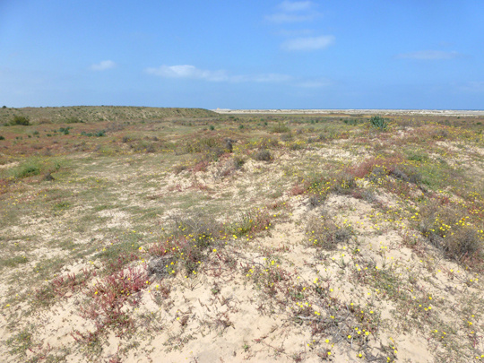
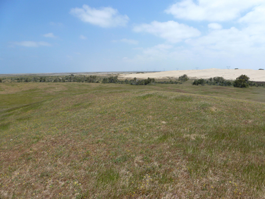
3. Sites West of Baltim
The sandy prominence running along the northern edge of Lake Burullus consists of a series of sand dunes and sandy flat areas that separate the sea from the lagoon of Burullus itself. From the east to the west the tells run as a band along the promontory, but not all of them constitute archaeological sites and the reason for their registration is now not clear.
3.1 Tell el Maqlowbeh (SCA090141; 31 31 10N, 30 48 20E) is a large sand dune. No pottery or other archaeological material was noted at the area except for a few Roman amphora sherds in an area dug out close to the tell for a modern construction. Any ancient area could have been buried.
3.2 Kom el Meqassabah (SCA090173; 31 30 04N, 30 44 29E) is a large sand dune of clean sand.
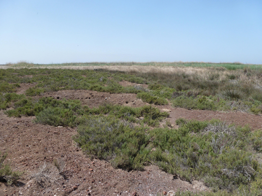
3.3 Mastarueh (SCA090177: 31 29 09N, 30 41 08E)
The site consisted of a series of dunes covered in vegetation. There was a good spread of pottery and pieces of stone on the highest mound areas, suggesting that their height provided some strategic reason for the use of the mounds. The pottery was most likely to be Late Roman and Islamic period in date, including some glazed wares and jugs made of marl clay with impressed decoration. A fragment of a red granite column lay to the west of the pottery covered mounds and the plants seemed to demarcate possible structures lying underneath the surface. The area covered by this type of ground cover was quite substantial and suggested that a large archaeological areas was concealed by the plants and sand at this place.
4. Lake Burullus Sites
4.1 Geziret el Dakhlah (SCA090163, 31 26 29N, 30 47 47E)
The island lies close to the edge of the fish farms in the southern sector of Lake Burullus. The 1:50,000 SoE map shows the island as a sizable mass, elongated from north to south, just over 3 km in length and 0.75 km wide at its maximum extent. The satellite image shows this shape, but it is clear that the edges of the island are made up of reed beds and submerged mud flats. There are two visible land masses comprising the island and we visited an irregularly shaped area lying at the north of the island. The aerial image showed dark areas in the centre and a large circular area cut out of the island at the north.
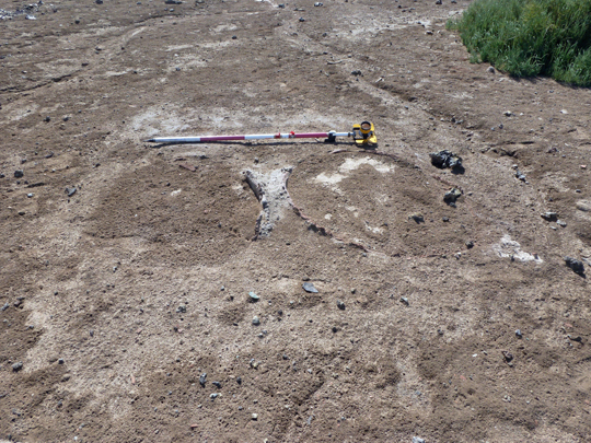
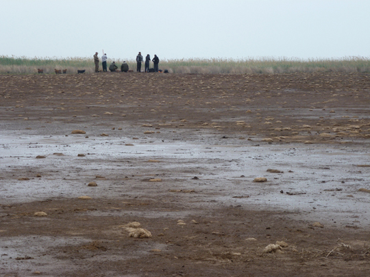
The area surveyed was approximately 210 m in diameter. At the centre of this area here was a recently dug pit and in fact there were a number of other pits around the area dug out to a variety of depths. The natural surface of the island seemed to be hard, flat dark-coloured mud, with some pot-fleck mixed in it, but without large pieces of pottery or fired brick. There were series of raised patches of pottery fragments, which formed the only elevated areas of the site. They may have been related to structural remains, although there were no standing features on the island. The north-eastern sector of the site had pottery fragments, glass pieces and some corroded bronze coins mixed together in denser and less dense patches. To the south of the area there had been much digging activity with a series of deep pits at the south-west edge of the area. The deepest pit had a visible section of about 1 m , but it was filled with water and the ranging rod could be put into the water to a depth of 1.5 m, suggesting that much material had been removed from it. Several of the pits therefore showed some archaeological stratigraphy relating to the structures on the site. One pit showed a basal layer of mud, then a grey-ashy coloured mud, then a layer of red-fired bricks and then a layer of broken pottery fragments up to the surface. In the base of one of these pits there was a large fragment of red granite, but it was irregular in shape and not clear to what it may have belonged. In all there were approximately 8 pits of more recent vintage and a few others, which looked older in date as they were more or less eroded and not as deep to begin with. To the north-east of the area there was a rectangular pit about 4 m long and 2m wide and deep.
In places, the diggings in the south had thrown up black burnt looking material and some slag fragments. On the south-west side the way in which the mud dried seemed to reflect building plans, but it may have been coincidental as there was little surface material in this area. There were also some areas of scattered shell concentrations, perhaps related to mud-brick structures made from mud dredged from the area of the lake.
Amongst the pottery and glass there were Late Roman fragments, including some CypRSW with impressed decoration on the outside (4-5th cent., see KU.P13), LR1 amphora necks and handles in abundance, as well as coarsewares and other red polished finewares. It seemed certain that these fragments were in situ and that there were deposits of up to 1-2m in places, but they seemed to have come from structures which were spread around the area.
4.2 Kom el Akhdar (SCA090108, 31 26 56N, 30 49 54E)
The 1:50,000 map shows the island as having a rectangular shape approximately 4 km in length from west to east and about 500m from north to south, with a short tail to the south-western edge. We visited the area to the north-west of the island, where there was a noticeable hill to the south of an oval body of water excavated into the north-western side of the island. In contrast to Dakhlah Island, the surface was sandy, with areas which were quite hard and other softer, finer sand.
The main tell was covered in fragments of pottery, glass and a few small corroded pieces of bronze. There were a few pits dug on the island, which had thrown up less eroded and larger fragments of pottery. Around the perimeter of the main mound, which had a maximum height of about 2-3 m, there was some material washed down onto the surrounding area. Approximately 100m to the east there was another mound, separated from the western mound by a sandy area with some fragments of large pottery vessels some of which were coated in white wash. This too had a good surface and subsurface coverage of pottery and glass fragments.
Further to the west and at the edge of this tell there was an area of hillocky sand, which was covered in small fragments of shattered bone. The only identifiable fragments were some cattle teeth fragments, but there seemed to be definite concentration of the bones in this place. It seemed that the surface could have been that of a robbed out cemetery and the large coarseware pottery fragments could have come from pottery coffins, but without any definite human bone, it was not certain – unless this was a cattle burial area?
Further to the west again there were more areas of shattered bone and large coarseware fragments representing the edge of the higher sandy area, abutting a fish farm dug into the island. The width of the site was probably no more than 200m.
The pottery and glass was Middle to late Roman in date with some fragments of CypRSW and glass lamps decorated with blue blobs. Although the material was largely the same date as that of Dakhlah the nature of the two sites was very different, with the muddier matrix of Dakhlah and the sandy soils of Akhdar (this in turn produced some quite luxuriant plant growth, perhaps resulting the name of the site). There were a few red bricks at the site but there were also some darker coloured areas perhaps as a result of mud brick features, which were not now visible on the surface.
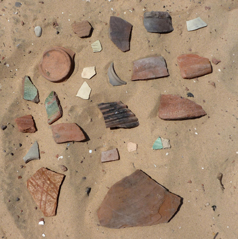
4.3 Tell Singar (SCA090150, 31 29 57N, 30 55 10E)
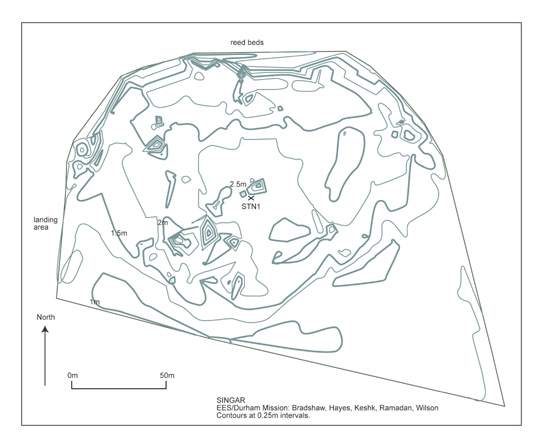
Click image to view at full-size. (Requires PDF Viewer browser plug-in.)
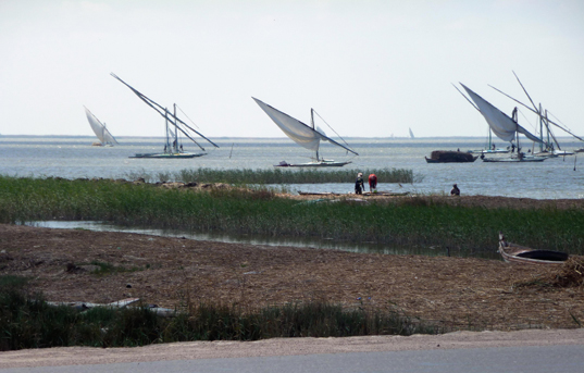
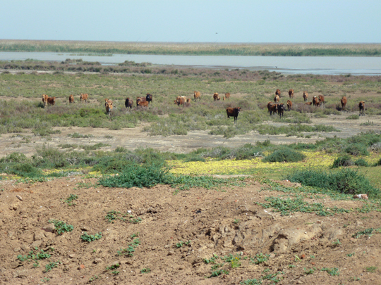
The tell is in Lake Burullus and maps show the island as being elongated from north to south. The tell was defined as a pottery and brick covered area to the south side of the island, which was bare from scrub and bushes. By contrast the northern area had a good area of marshes and reed beds, along with harder sandier surfaces and some vegetation. Cattle were grazing on the island. The pottery area seemed to be very low lying and covered an area of approximately 90 m by 140 m at its maximum extents. The height of the tell was barely a maximum of 1 m above the level of the water.
As the site had been previously occupied by fishermen in the not too distant past, the remains of their dwelling places were clearly visible on the island. In many places hollows had been dug out of the island leaving earth piled up alongside the hollows and the pottery and material from the holes lying around the hollows. The pottery dated to the Late Roman period through to the Islamic period and there were some red slip wares along with the glazed wares. Although the area was not very extensive the material seemed to occur in dense strata across the site which was around 1 to 2 metres deep in places. The edges of the site were bordered by reed beds.
Summary
The survey of 17 sites in the Kafr el Sheikh area added to the known Late Roman period and medieval Islamic sites and showed some interesting groups of such places. The Baltim medieval sites suggest a development of the north-western side of the Burullus lagoon perhaps from the 12th century onwards, while the substantial sites with abundant material in the southern marsh area of the lake suggest a development of settlement in this area during the 4th to 7th century, perhaps connected with developing waterway networks in the Late Antique period. Such sites should contain churches and administrative buildings due to their size and location. Further work would be necessary to identify the different zones of each site.