Mahmudiyah
Mahmudiyah
Mahmudiyah lies on the west bank of the Rosetta branch, opposite the town of Fuwa. It was a major crossing point on the river and some have suggested that it was the site of ancient Metelis.
Sidi Uqaba (SCA 100141) (Map number 45)
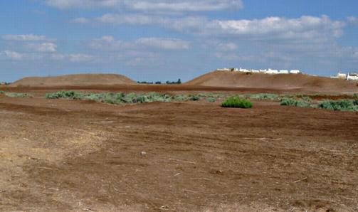
This site was probably once one mound but it now consists of three separate small hills covered by a cemetery, with an excavated depression lying in the centre of the site and a flatter area, now a football pitch, to the south.
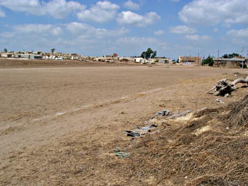
Football pitch beside the kom.
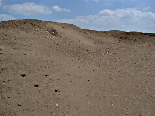
The area covered by the site is 260 m from north to south and 270 m from east to west. The highest mound at the site is around 4 m above the level of the surrounding fields. On the southern side of the site there is a small area of reed and grass scrub which is still regarded locally as Antiquities’ land. To the east of it, there is another small cemetery mound upon which is the tomb of Sidi Uqaba.
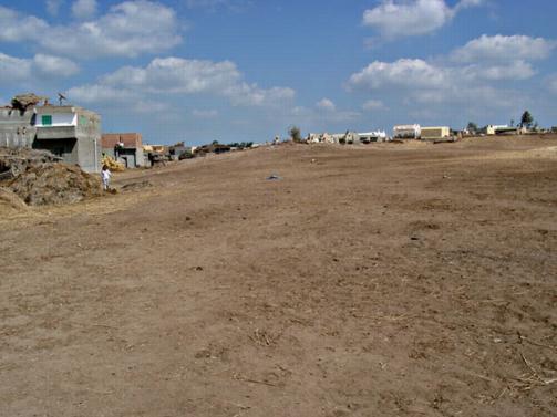
Cemetery at Kom Uqaba.
Pottery at the site included some green glazed wares and material from the 6th to 8th century AD.
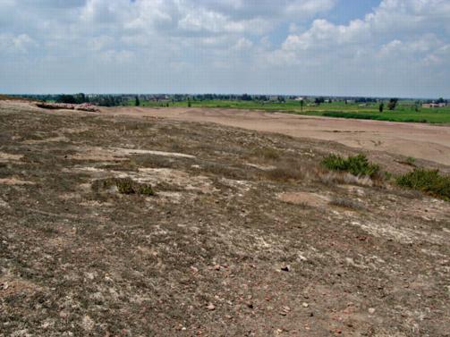
Kom el-Ghuraf (SCA 100164) (Map number 46)
This site was visited in 2002 by the Delta Survey and now is the concession of an Italian Mission from the University of Rome, which has excavated some red brick Late Antique tombs.
View from the top of Kom Ghuraf, with red brick structure embedded in the mound on the left.
Kom el-Wast (SCA 100170) (Map number 47)
This site lies 2 km to the north of the latter and can be seen from it. The site is around 400 m from north to south and 400 m from east to west. The kom has a maximum height of 6 m above the level of the surrounding fields. The site consists of a flat outer area, slightly raised above the level of the surrounding fields, with a mound in the centre.
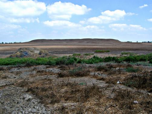
The substantial mound of Kom el-Wast.
The high southern part of the mound slopes down towards the north, where it forms a low ridge at the north end of the site. The centre of the mound, however, has been dug out and now forms a significant hollow in the centre of the site. This evidently fills with rainwater, but in our summer visit it had dried out, leaving dry, cracked mud behind.
Detail of mounds showing brick and pottery lying in dense concentrations on the surface. They may represent the interior of structures.
On the northern ridge there are clear house plans. They are the traces of house walls where the walls have been eroded away, leaving behind only the last few courses of mud bricks which can be seen on the surface. The corner of one of these houses contained a small lekythos (jug) vessel and a large, corroded, bronze coin, both of which were taken into the care of the local Antiquities Inspectorate. Pottery so far identified at the site is Ptolemaic in date.
Kom el-Ahmar (SCA 100120), near the village of Rodat el-Moazi (Map number 48)
This is a large site, about 650 m from east to west by 450 m from north to south. Originally there seems to have been one large mound here which was severely affected by sebakhin digging in the nineteenth and early twentieth century. There was once also a branch of the Delta Light Railway running into the site. In its present condition it consists of five main mounds with an excavated area in the centre. The north-east mound is around 10 m above the level of the fields and is now covered by a modern cemetery. The central mound is 8-9 m in height, grey in colour and has a flat surface on the top. The texture is compact and because of the grey colour, parts of this mound seem to made of mud-brick. The other three main mounds to the north-west, south-west and south-east of the site have sides sloping to a narrow area at the top and are covered in varying amounts of pottery, glass and red brick debris. The south-western mound is threatened by agricultural encroachment.
The southern and north-eastern mounds of Kom el-Ahmar, from the south.
The most striking feature of the site is the complex of red brick structures which have been revealed in the central area. The main building has several vaulted chambers and plastered walls, with rounded buttresses at the southern end. This was excavated in 1942 and published as a bath-house by El-Khashab. Bath-houses are an important feature of some of the Beheira sites and can be dated to the Imperial Roman period and sometimes the later Roman period. They are a symbol of the Roman administration of a town because the bath houses were such an important feature in Roman social and economic life.
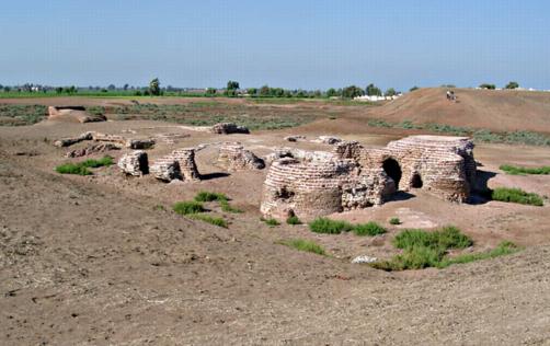
Bath-house building at Kom el-Ahmar.
A granite grinding stone and an eroded granite column base lie on the surface of the excavated areas. The granite may be derived from an earlier phase of this site or have been brought here from further afield.
The pottery from the site covers a wide date range and several periods including Saite, Ptolemaic to the 2nd century AD and 4th to 10th century AD are well represented.