Abu Matamir
Abu Matamir
This is the area to the south of Alexandria and Lake Mariut, extending to the Western Desert. Abu Matamir is a town with a strong frontier flavour, where desert bedouin can be seen mingling with the farmers of the redeveloped agricultural land at the desert edge.
Tell Makboura (SCA 100223) (Map number 3)
The site is a flattish mound with a gently sloping northern side, perhaps rising up to 3 to 4 m above the level of the roads and fields. The extent of the site is 270 m from north to south and 220 m from east to west. There is a secondary mound to the east which may have been part of the original larger site at one time. The houses on the western side of the tell are slowly encroaching onto it, although the top of the mound is clear except for rabbit hutches and dung patty stores on the north of the mound. The fields to the south of the mound contain noticeable quantities of pottery and some limestone fragments, again suggesting this was once a more sizeable mound. The pottery here consisted of both fine wares, domestic material and amphorae.
The nearby Tell el-Jil was not visited but seemed to be a smaller version of this mound. See also Kom el-Farag and Kom el-Mahar in Kafr Dawar.
Kom el-Adda (SCA 100230) (Map number 6)
This site lies to the south of the road running east-west and is now built over by a village. The land is still clearly raised approximately 2 to 3 m above the level of the road and fields, but nothing of obvious archaeological significance is visible.
Tell Trugi (SCA 100251) (Map number 13)
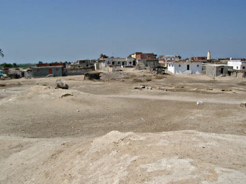
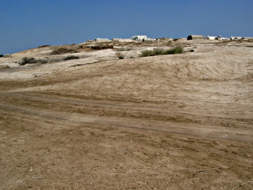
This was an extensive site and was perhaps once a high mound. Now it consists of flat, sandy areas interspersed with several excavated red-brick structures. To the north of this area is a modern village with an adjoining cemetery, both of which may have been built upon part of the original site. The area covered by the site is 350 m from north to south and 300 m from east to west, but the largest flat sandy area has a football pitch running down to the road.
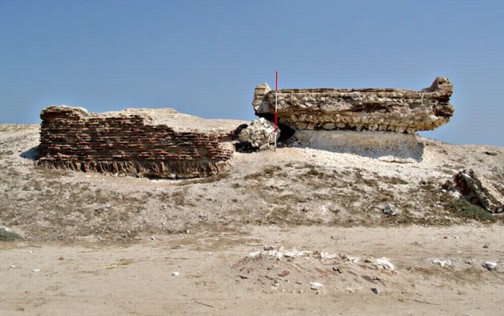
Amongst the brick structures at the site there is part of a pavement left standing upon its sandy, brick foundation and a pillar of earth; red brick and plastered tanks — perhaps for the production of wine or oil —; and a part of a limestone wall. Five courses of ashlar blocks survive for a short length of wall made from limestone from the northern coast. One side still has some plaster adhering to it. All of this area seems to have been dug out to below the floor level of these buildings and so the site seems very denuded now. There were Egyptian excavations here in the 1940s and in 1992. The flat area apparently shows building plans in wet weather, according to the local people.
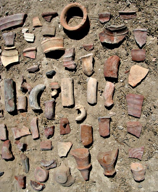
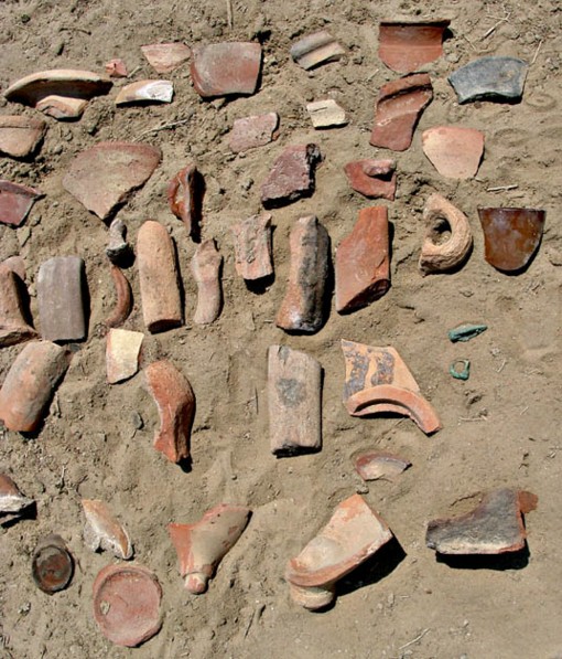
There are a number of granite grindstones at the site and the pottery dates from the Ptolemaic period up to the 4th century AD, with some Islamic material also mixed in with the sherds. Because of its disturbed nature, however, it is difficult to associate particular pottery with specific areas of the site.
Abu Gudour (SCA 100212) (Map number 14)
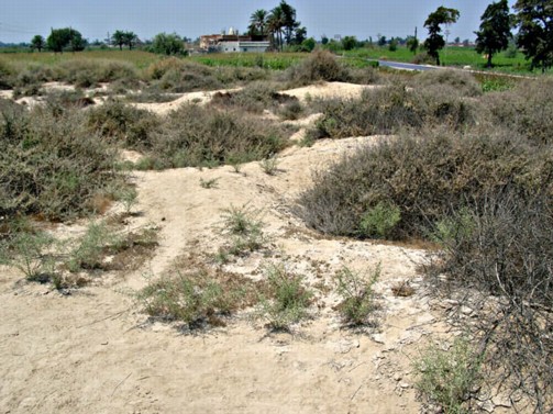
This site once covered an extensive area but now consists of some low, sandy mounds covered in scrub and a larger flat area with scrub and bushes. Most of the site is now being used a municipal rubbish dump, having once also been a gravel extraction and processing area. The highest mound is only about 2-3 m above the level of the road and surrounding land and the whole area is very sandy. The flat area to the south and east covers a large area, but it is not clear if this was always part of the site here or whether it is natural terrain at the desert edge which has not yet become farmland. There was Roman pottery on the tell and perhaps some other earlier material. The team also noted a stirrup ring made of bronze and a bronze three-flanged arrowhead.
This may be a strategic location for a small military establishment and would be worth further investigation following the Egyptian excavations conducted at the site in 1984. The measured extent of the land is about 300 m from east to west by 250 m from north to south, but could originally have been much greater. The relationship of this site to the other western delta fortified sites and to the road here would also be worth investigating.