Abu Hummus
Abu Hummus
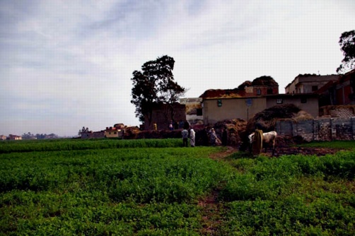
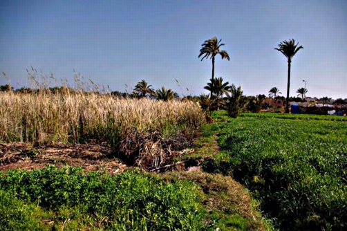
The town of Abu Hummus is named after a sheikh who was born and is buried there in the main cemetery. The town stands on the main Alexandria to Cairo Agricultural Road. The sites visited in its vicinity lie mostly to the north, as far as the northern coast and the area of Lake Mariut.
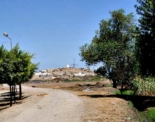
Sidi Yusef (SCA 100143) (Map number 19)
This site is on the north side of the main Alexandria-Cairo road and south of the railway line. A short dirt track leads to it from the road and to the south of it there is the main Alexandria-Cairo railway line. It is marked on the Survey of Egypt map as lying on either side of the main road, but the southern part of the site is not apparent. The small hill is covered by a cemetery with the tomb of Sheikh Yusef at the top. To the east of the site, there is a small area of waste land with sherds and red-brick fragments lying on the surface and present in the sides of the eastern ditch. The mound covers an area of 180 m from east to west by 160 m north to south and it is approximately 4 m above the ground level.
Kom Hassan II (SCA 100174) (Map number 20)
This seems to have been the name for some Antiquities’ land to the north of the village of Muturis, where some excavations took place a number of years ago. There is nothing here now, except for the village.
Kom Khaleesh (SCA 100175) (Map number 21)
The kom is a low, flat mound, approximately 2 to 3 m above the surrounding fields, with a sandy surface measuring around 100 m from east to west. On the eastern side is a cleared, flat area, lower than the main mound. Parts of the surface of the mound are covered in darker dry mud and low scrub, while in other places the sand is most obvious. There was some pottery on the surface of the mound and in places where holes had been dug into the sand. No features could be discerned, but at one side there was a fragment of a red brick wall in the side of a drainage ditch. The tell could benefit from a magnetometer survey and seemed to be the most promising site in southern Abu Hummus. The pottery showed two main dating concentrations : (i) the Ptolemaic and early Roman period and (ii) the 6th to 8th century AD.
Kom el-Qanater(SCA 100166) (Map number 22)
The village of Kom el-Qanatir (spelling according to the 1:50,000 Survey of Egypt map) is situated upon a small, low mound, with some deep pits filled with water next to it which may have been part of a kom reported to have once existed all around the village. A few pottery sherds were visible on the cleared areas beside the village, but it was not clear from where they originated.
Kom el-Boos (SCA 100108) (Map number 23)
The village of Kom el-Boos is situated upon a mound, with the cemetery in the centre of the village on the highest part of the mound, up to 4 m above the fields around the village. The cemetery mound is surrounded by inhabited houses, many of them still built of mud brick, and the village is close to the canal of Kanawiya. There were a few pottery sherds embedded in the surface of the mound and the western side part of it was cut away, showing some stratigraphy. The sherds noted in this place were worn and not very numerous.
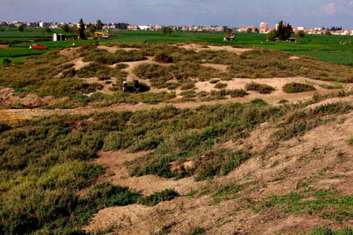
Kom Debaa (Map numbers 24 and 25)
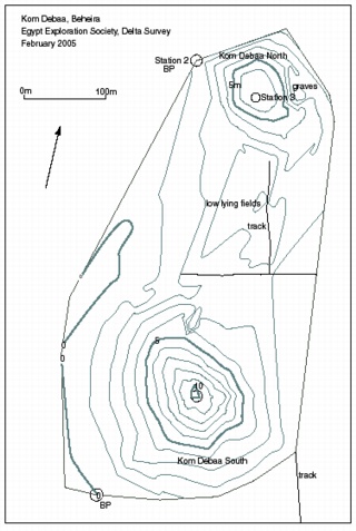
Click image to view at full-size (requires PDF Viewer browser plug-in).
Two sites, Kom Debaa north and south, lie near the shores of Lake Mariut. They may once have been linked, with Kom Debaa north serving as the cemetery for Kom Debaa south, although the preliminary findings from the pottery study suggest that the south site is earlier, with occupation shifting to the north. A series of drill augers at the site suggested that the site was founded upon a sand-bank which had been covered in alluvial silt, providing a firm and high foundation mound. Before the Ptolemaic settlement there may have been a river channel to the west, flowing through a swampy area. The silt deposits from such a channel created the levee upon which the Kom Debaa sites were founded and existed until the silting up of the channel in the Late Antique period.
Kom Debaa el-Bahri (North) (SCA 100113) (Map number 24)
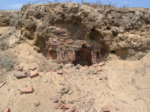
This is a small, narrow tell with an ancient cemetery upon it. The maximum dimensions of the remaining area are 140 m north to south, 150 m east to west and approximately 5-6 m in height. It has been cut away at the sides by fish-farms and was once more extensive in size. The surface matrix is very sandy, but on the eastern side, where the tell has been cut away, a number of graves are visible. These consist of burials in pottery coffins of various shapes, including long, narrow coffins in two parts, large pottery vessels and also red-brick vaults. This eastern side of the tell is less densely covered in pottery than the western side, where more sherds and red-brick debris are visible on the surface. The pottery could be dated to the Late Roman and Late Antique Periods, with only a few sherds of Ptolemaic and Early to Middle Roman period. To the north of the site there are fish farms which continue into Lake Mariut.
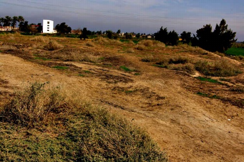
Kom Debaa el-Qebli (South) (SCA 100114) (Map number 25)
The maximum dimensions of the site are approximately 450 m from north to south and 300 m from east to west. The north-south measurement includes the large cleared area at this site; excluding the latter reduces this axis to only 300 m in length.
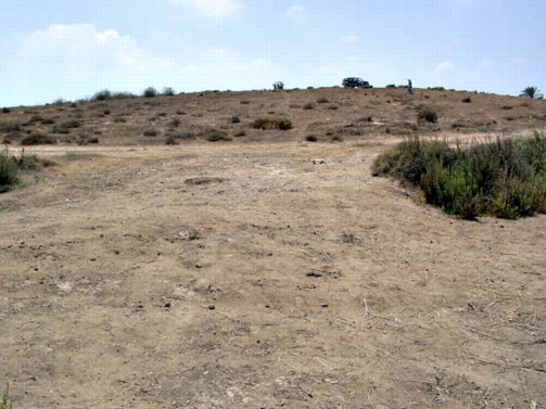
The site is a low hillock, approximately 8 m high at its highest point above the surrounding fields. The sites of the kom slope gently up to the highest point in the centre of the hill. On the south-western side there is a cleared flat area which may once have been part of the original mound, but is now being brought into the fields on this side. Traces of house plans can be seen on the north-eastern side of the mound slope near the top. Pottery material has been dredged from the bottom of the deeper ditches around the mound area and dumped onto the lower areas of the site. The surface of the whole mound is evenly covered in pot sherds, including fine-wares, red-brick fragments and some red orthoquartzite fragments. The material could be dated to the Imperial Roman period (that is, Early to Middle Roman), with only a few examples of Late Ptolemaic and Late Roman pottery. This is an interesting contrast to the pottery collected from the north tell. While the apparent shift in occupation from south to north may reflect the sampling strategy, further work could indicate whether the mounds were occupied extensively at different times.
Kom Tagala (Map number 26)
This site has been released by the SCA and is currently being developed by the construction of a waste-water processing plant, a school and a civic centre. On the 1:50,000 Survey of Egypt map, the site lies next to Ezbet al-Jallad. Originally the land covered 25 acres, according to locals. The site seems to have been a low, sandy mound and a few pottery sherds were still visible on the surface. In an area where a bulldozer had excavated a deep trench the sandy soil contained a large amount of pottery dating to the Roman period. There did not seem to be any evidence for structures on the surface, but there were a few fragments of red and mud brick mixed with the sand. The pottery included a few sherds from the Ptolemaic period, but the majority was concentrated in the 6th to 7th century AD.
Kom Hashiem (SCA 100189) (Map number 27)
The site known by this name does not agree with the location given to the site in the SCA mapping atlas, but it is clearly marked on the Survey of Egypt map. The local gafir said that this was definitely the location of Hashiem, but there was little to be seen in this place. The site consists of a sandy area, with a few pottery sherds lying on the surface. On the southern side, there was an area of mud brick or an embankment. The pottery found consisted of small- sized sherds, but among it there were two pieces of African Red Slip ware which were dated to the 5th and 6th century AD. This could be an outlying area related to Kom Aziza, which is not far away. Together the two areas could have formed a similar site-complex to the two tells at Kom Debaa.
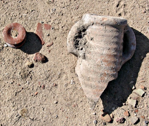
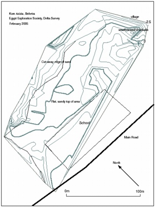
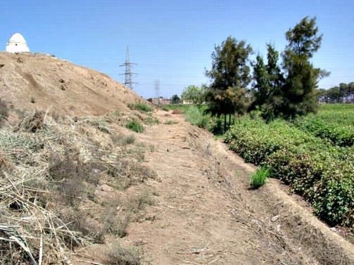
Kom Aziza (SCA 100180) (Map number 28)
Click image to view at full-size (requires PDF Viewer browser plug-in).
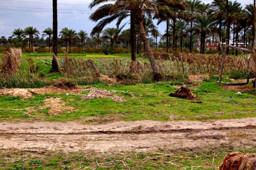
The site lies on either side of a small canal and main road. To the north of the road and canal there is a low, sandy mound with a hamlet and new school at its edges and to the south of the road upon a mound there is the larger village of Kom Aziza. The area to the north is 130 m north to south and 160 m east to west and is about 2-3 m above the level of the surrounding fields. The surface of this part of the site contained pottery sherds and in the playground of the school some larger oven outlines and traces of walls were visible. At the northern side, the tell has been cut away, revealing substantial deposits of pottery, including whole amphorae, to a depth of about 3 m at the deepest part of the section. There is a small village on the eastern side of the site which may be built over part of the ancient site.
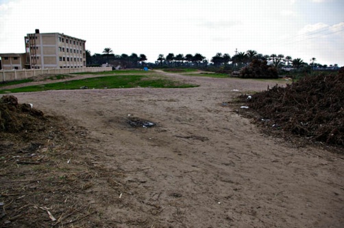
The village to the south is quite extensive but has no obvious ancient features. Further along the road to the east there is a cemetery upon a low mound with a dug-out area now filled with water and reed beds. This may also have been part of the original site. North of the area there is a depression which is now part of the orchards and agricultural land. Further along the road to the west there is the major site of Schedia at Kom Giza and Kom Hamam, so Aziza may have been part of the port and harbour system.
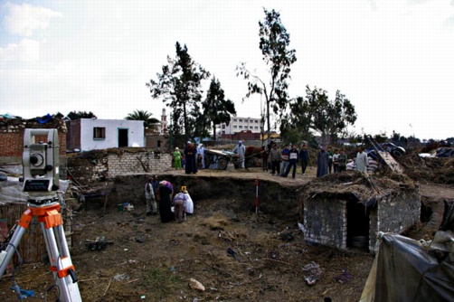
Two drill auger transects across the north and south of the site suggested that parts of the site had a long settlement history, with core 7 drilling 5.17 m through a sandy-silt matrix containing burnt material, bone, pottery and brick fragments. The pottery from this core included a bowl rim sherd and bread mould fragment which may date to the end of the Old Kingdom. Other pottery from the site dated to Dynasty 26, although this was made from a surface collection and may not necessarily have originated here, whereas the pottery from the sandy section included amphorae fragments, cooking pots and pie-crust casserole dishes, all dating from the 4th to the 7th century AD (Late Antique).
The site at Aziza is of considerable interest. It may well have had a long life and was undoubtedly linked to other important centres in the region, including Koms Giza and Hamam to the west and Hashiem to the north.
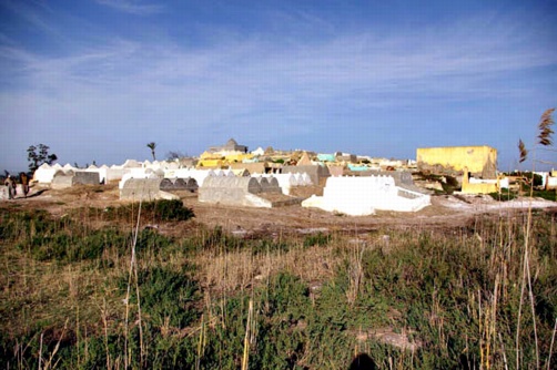
Abureh (SCA 100146) (Map number 29)
This site lies to the north of the sand hill named Tell Bisintawy and should probably be considered as part of the same geological formation. Abureh itself seems to consist of two separate areas: Abureh, the guava orchard and cemetery area; and Abureh-Tell Hishmad, now occupied by a village called Ezbet Ashushi-El Askari and its large cemetery. Cores were drilled across this area and on to the east to obtain information about the depth of the sand deposits and the underlying geology. The cores showed the gradual build up of the sand hill layers, perhaps helped by the deposition of alluvium at Abureh 1. There was a clear lack of deep archaeological material, which suggests that the sites could have been settled only in relatively recent times.
In the orchard at Abureh, there was pottery lying on the surface and the upper drill cores brought out some brick fragments. This material could have come from an older cemetery, but was not necessarily ancient in date. The pottery studied at the site ranged in date from the Ptolemaic period to the 6th century AD.
Tell Bisintawy (SCA 100124) (Map number 30)
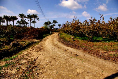
The Survey of Egypt 1:50,000 map shows a low mound area of some size at this location, reflecting earlier maps which show Tell Bisintawy as a low, sprawling series of mounds, which were perhaps originally river bank levees. The whole area is now under orange tree groves and although the sandy mound is noticeable because of its height of up to 15 m above ground level, it is difficult to see any traces of an ancient site. A water processing station has been constructed on the top of the mound at the southern end and this may have been built over an area of wasteland. Some pottery was collected at the site, but there was not much lying in the orchards. The hill certainly seems to provide a strategic location for an ancient settlement of some description, but a more exhaustive survey will be needed to establish the exact significance of the site.
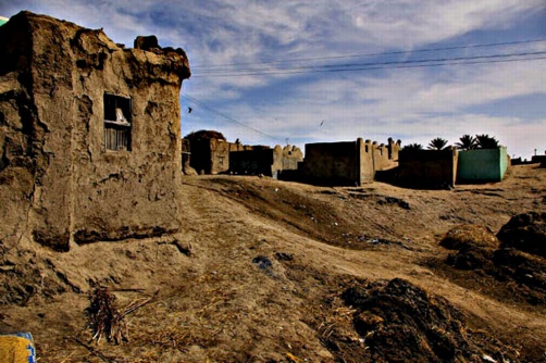
Tell Nakhlah (SCA 100122) (Map number 31)
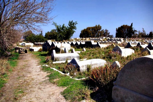
This seems to have been an extensive site at one time, but it has almost completely vanished now. There is a village and a cemetery upon the most prominent mounds at the site, being approximately 4 m and 3.5 m high respectively. At the southern end of the site there was a football pitch beside an area of animal rearing and dung patty production. This area was the richest in sherds and the local gafirs indicated that there was archaeological material, mostly pottery sherds, in the area beyond it. There was also a lake filled with brackish water to the north-east of the site which may have been connected to the removal of sebakh and earth from the site.
The dimensions of the site are about 320 m by 300 m, but this may not be the true extent of the village or the archaeological material here. The pottery had a wide date range and included some Ptolemaic period sherds as well as material from the 7th century AD. On the face of it this seems to be a long-lived site.
A meteor is reputed to have fallen to earth at the village in the early twentieth century.
Views of Tell Nakhlah.
Ganadi (SCA 100137) (Map number 32)
The remaining site at Ganadi lies underneath a cemetery attached to a village, with an area between them where animals are stabled. The actual mound is about 2 m above the level of the surrounding land and the whole site measures approximately 50 m by 140 m. There was very little pottery lying on the surface of either the cemetery or village, but some was recovered from the ditch around the site. It dated from the 3rd to the 6th century AD.
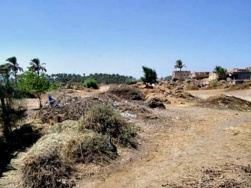
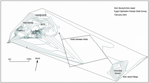
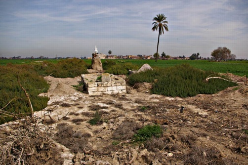
Kom Barsiq (SCA 100181) (Map number 33)
Click image to view at full-size (requires PDF Viewer browser plug-in).
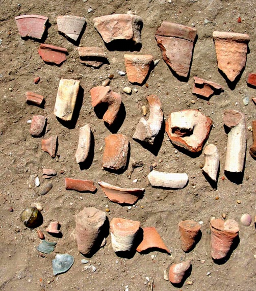
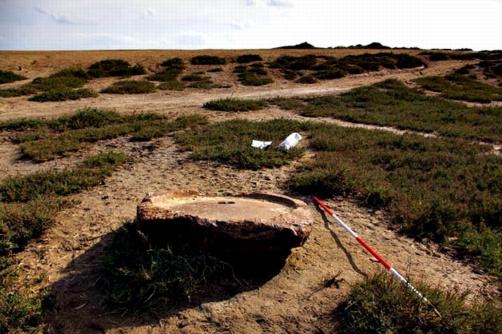
The extent of the present site is about 200 m from east to west and 160 m from north to south. The site consists of a flat area with three main small mounds. There are two flat, sandy mounds which are clear of plant growth and a higher, ridge of darker mud, approximately 6-7 m above the field level, which may be the remnant of a structure made from mud brick. This is covered in small bushes and scrub which extend down into the dug-out areas between the mounds. In the south-eastern sector of the site there are the stumps of palm trees which once grew here as well as signs of sebakh-digging. One of the trees had grown around an amphora which has remained in the stump of the palm. A sheer section through the mound on the northern side shows considerable pottery sherd dumps. Also on this side there is a cleared area where burials in pottery coffins are clearly visible at the surface. The lower mounds are up to 4 m in height. A quartzite grinding stone was noted at the site.
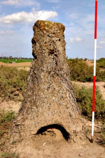
Left : An amphora trapped in a growing palm tree.
Below : A quartzite grinding stone.
The fields to the south also contain pottery, suggesting that the mound may have originally extended further. The village of Ezbet Kom Awad to the south-east includes a cemetery which stands upon a low mound and the whole village seems to stand up above the field level. It is possible that the two places were once settlements, but only Awad has continued to exist or that Barsiq was the original village in the Roman period and at some stage the site was abandoned and its people moved to found Awad.
The pottery in the section seemed to be mainly a mixture of large amphorae sherds, most likely from Lower Egyptian production centres. Few fine wares were noted on the surface of the site. The pottery dated to the Late Ptolemaic period (2nd to 1st century BC), with a few possibly early Ptolemaic and some early Roman pieces.
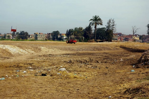
Kom Saieda (SCA 100139) (Map number 34)
The site is a cleared sandy area next to a large rice processing factory. The main concentrations of pottery were to the southern end of the site in a small 100 m by 50 m area with some small sandy mounds. None of these mounds was very high and the site has almost no elevation. The pottery was interesting, with material dating to the Ptolemaic period as well as the Late Antique period, specifically the 6th century AD.
Tell el Qarawi (SCA 100116) (Map number 35)
The site is a mound approximately 7 m in height with steep, almost sheer sides and a cemetery built atop it. The tomb upon the top of the mound was that of Sheikh Mohamed el-Qarawi. The area covered by the site is about 230 m by 250 m.
A little pottery was collected from the mound itself and some material was noted in the fields lying around the site, but it was not lying in dense concentrations. The fields all around the site lay about 0.75 m to 1 m below the level of the base of the mound. On the eastern side of the site there is evidence for a red-brick building and maybe some mud-brick structures but it is not clear how extensive or how old they may be.
Geradat (SCA 100109) (Map number 36)
This place is named as Al Jaradat on the Survey of Egypt map. There is a village here, but no obvious Antiquities’ area. Further along the same road is Kom el-Basal, which is also a built-up village and not an Antiquities’ area. Nearby is the village of Deir Amis where there is a cemetery mound in the middle of the village with a new school building near by. This can be a sign of an older site, but the name of the village suggests a connection with a Christian church or monastery.
Balbaah (Map number 37)
This area is a 1 m to 2 m high, sandy mound which has been flattened and cleared to make a football field. On its eastern side there is a triangular area of land with the remains of SCA excavations. Some pottery was noticeable in the fields around the area, but there was little pottery on the site or next to the SCA excavations.
Kom Sebah II (SCA 100110) (Map number 38)
This area seems to be area marked on the Survey of Egypt map as a small shrine next to the road, north of Ezbet Abu Shaffaf, with Kom Rizq (SCA 100178) to the east. The kom consists of two areas on either side of a road. On the west side of the road, there is a small area about 1-2 m above the level of the fields. It is used to keep animals and for drying hay. On the east side of the road, there is a small cemetery with a shrine in the centre. It is not a building, but consists of a structure of bricks, with white flags and recently burnt candles upon it. The whole area is about 70 m from eat to west and 30 m from north to south. According to the gafir it once was an area of 1.5 hectares extending as far as a lone palm tree in a field. A few sherds were visible in the fields and in the section of a ditch with pumps at the south side.
Kom Sebah I (SCA 100111) (Map number 39)
This village lies to the north of another named Abu Ghraia and both seem to be part of the same kom area, north of the Alexandria-Cairo road, and are perhaps associated with the site of Barsiq-Awad. Neither place is marked on the Survey of Egypt map. Kom Sebah itself is situated on a small mound, about 2-3 m above the fields at its highest point. It is difficult to see the mound because of the densely packed houses but in some wall foundation ditches and in the irrigation channels there was a good amount of ancient pottery sherds. The whole area is about 230 m north to south by about 80 m east to west. The village has a boundary wall on its northern side, which seems to be a feature of the villages in this part of Abu Hummus.